2016:497 - RIVER LEE, Cork
County: Cork
Site name: RIVER LEE
Sites and Monuments Record No.: N/A
Licence number: 16D0053 and 16R0079
Author: Rex Bangerter, ADCO
Author/Organisation Address: No. 2, Main Street, Bennettsbridge, Co. Kilkenny
Site type: Industrial site
Period/Dating: Modern (AD 1750-AD 2000)
ITM: E 566718m, N 571985m
Latitude, Longitude (decimal degrees): 51.898626, -8.482940
Underwater Archaeological Impact Assessment (UAIA) of the River Lee, carried out as part of pre-planning conditions associated with the River Lee (Cork City) Drainage Scheme. The in-water assessment comprised c. 7km stretch of the River Lee, encompassing a 500m stretch of the waterway at Ballincollig, and both channels of the river as they flow through the centre of Cork. The assessment recorded riverbed topography and provided a detailed account of the existing riverside environment. On-site work comprised systematic non-disturbance underwater and waded inspection of the river channels, their attendant quayside structures, and any associated riverine features, including bridge structures (piers and foundations), weirs, culverts, river-walling, and any natural features encountered. On-site work was carried out between the 7th and 16th of June 2016, under licence from the DAHRRGA; licence numbers 16D0053 and 16R0079.
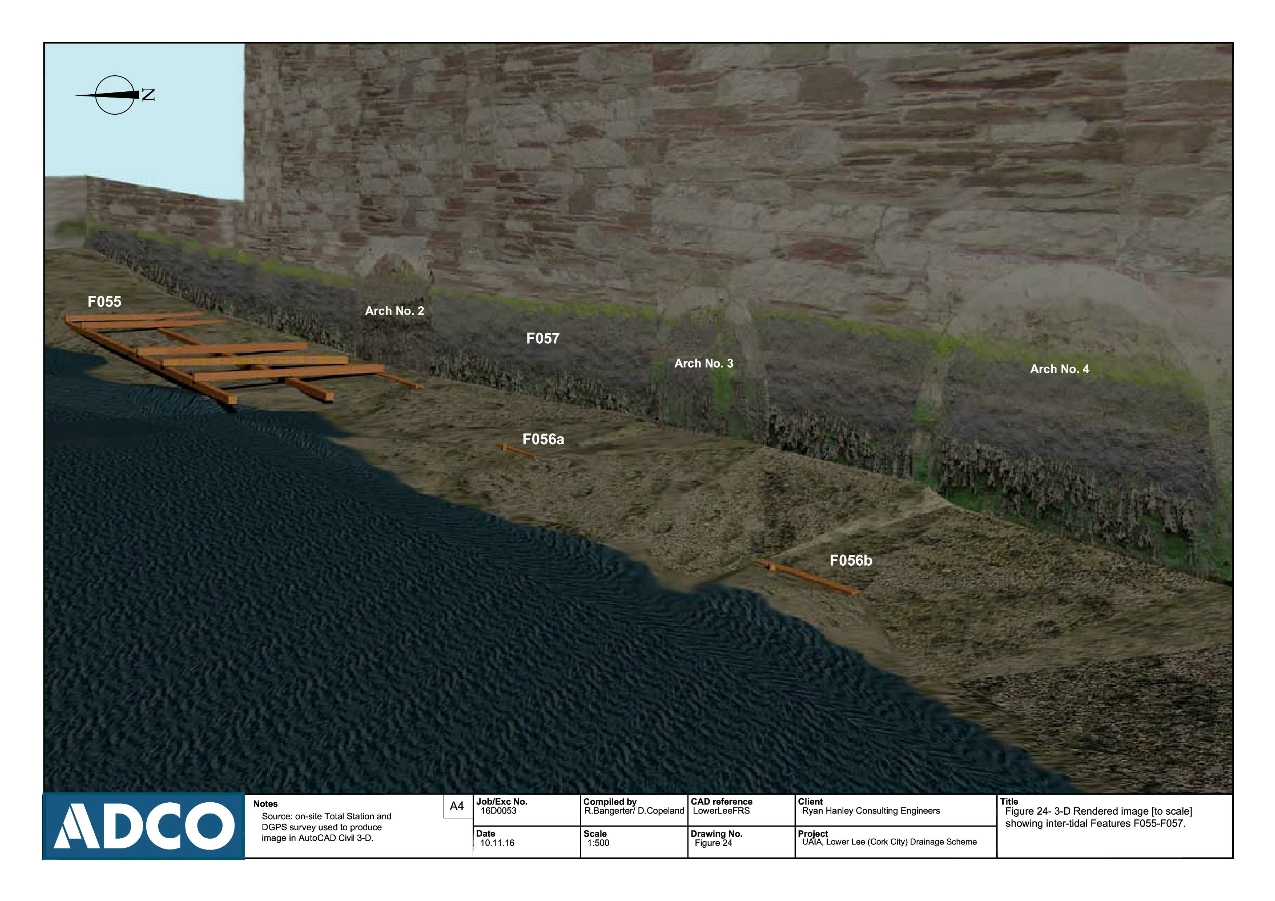
The UAIA identified fifty-seven known or previously unrecorded features of historic/ industrial archaeological significance within the River Lee study area (Features F01-F057). Identified features include: twenty-one bridge structures (F001-F021); multiple sections of masonry quayside (F023-F045), associated culverts (F33a, F40a, F041a, F045a); and nine weir structures (F046-F054). A set of previously unrecorded features (F055-F057) were also encountered for the intertidal foreshore adjacent to Lee Mills, located on the North Channel. These include a timber structure (F050), forming part of a possible barge landing platform, timbers from an associated timber walkway/jetty structure (F051), and a number of arched-culverts (F057). Further archaeological work is to take place in advance of construction at five locations. These include Alderman Reily’s Bridge (F005), Crosses’ Green Quay (F36/F036a), an unnamed quay (F039), the downstream side of Albert Quay and its associated timber Wharf (F045/F045a), and a section of riverside wall at Lee Mills (F057).