2015:556 - TRIM: Porch Field, Meath
County: Meath
Site name: TRIM: Porch Field
Sites and Monuments Record No.: ME036-048053; ME036-048054
Licence number: E004602
Author: Niall Roycroft, c/o Meath County Council
Author/Organisation Address: —
Site type: Historic town
Period/Dating: Multi-period
ITM: E 680739m, N 756801m
Latitude, Longitude (decimal degrees): 53.554911, -6.781480
Project 1: Monitoring took place of signage locations over an area of approximately 50ha, but the posts were in the vicinity of numerous RMP sites, and of National Monuments. Post-holes for signage were generally 0.3m x 0.3m x 0.3–0.4m deep.
In summary:
• Post 3, next to the ‘Sheep Gate’, showed loose recent dumps: possibly side-cast topsoil from previous footpath or other works.
• Post 4 next to the ‘Yellow Tower,’ showed the upper surface of a layer (0.2m down) containing medieval and post-medieval material from the demolished St Mary’s Abbey and other later buildings.
• Map Board 4, Post 14 and Post 15 appear to show the location of a/the demolished Newtown Trim western precinct/boundary wall, oriented north-south for approx. 60m (and therefore an implied external ditch—occasionally visible in the present landscape). The absence of any potential precinct wall remains in Post 16, 180m further north, may imply the wall slanted off to the north-east, perhaps parallel to the Newtown Trim graveyard wall.
• Post 13 was inside the Newtown Trim graveyard but within the construction cut for a large gate pier. No human remains.
• Map board 3 and Post 12 showed (through staining and gravel-grit, possibly pre-medieval natural deposits) that the modern (canalised) stream through Newtown has been running in this general location for a considerable period.
• Post 20 showed dumped, dredged material from the Boyne Drainage scheme. This material has been mounded alongside the River Boyne for 0.8-1.5km (up to 2.7ha) and could contain archaeological objects from the River Boyne.
• Posts 7, 8, 9, 16, 17 and 18 all showed agricultural soils (c.0.2m topsoil over subsoil) of the Porch Field. Posts 11 and 19 showed a positive lynchet in a plough headland (topsoil more than 0.4m deep). Modern finds.
• Alert Posts 1, 2 and Posts 5, 6 were all in land previously disturbed by the R154 Ring Road.
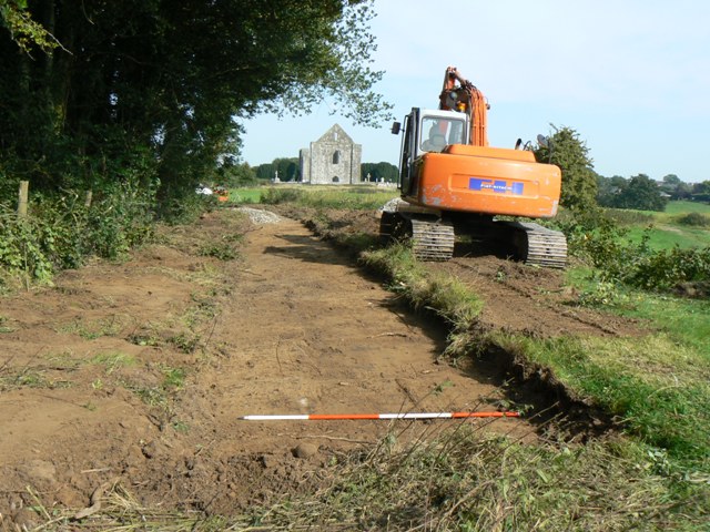
Project 2: Trim Trails footpath
The 2015 footpath was constructed to be 1.8m wide with wooden plank kerbing; all spoil was retained on site for landscaping. Grass sod was removed only to a maximum depth of 0.1m – usually less. In total, the distance of footpath excavated and surveyed was 1150m. Topsoil adjacent to the R154 Ring Road had been previously disturbed.
A total of 360 metal finds showed an overwhelming association with 19th–20th-century horse-based ploughing. Apart from a coin (Penny, George IV, 1822), a button, a quality (but pinless) buckle, a lead musket ball (18mm diameter) and modern fencing items, the entire assemblage was plough- or at least agricultural- based. The items included horseshoe nails, horse hoof and frog cleaning items (including keys, spoons, a chisel and other various short pieces of metal) as well as items from carts (e.g. large-headed nails and rivets) and harnesses (strap buckles). These metal finds were associated with small pottery, clay tobacco pipe and brick fragments typical of manured fields.