2015:549 - CABRAGH, Meath
County: Meath
Site name: CABRAGH
Sites and Monuments Record No.: N/A
Licence number: 15E0501
Author: Kieran Campbell
Author/Organisation Address: 6 St. Ultans, Laytown, Drogheda
Site type: Excavation - miscellaneous
Period/Dating: Modern (AD 1750-AD 2000)
ITM: E 692324m, N 760542m
Latitude, Longitude (decimal degrees): 53.586612, -6.605586
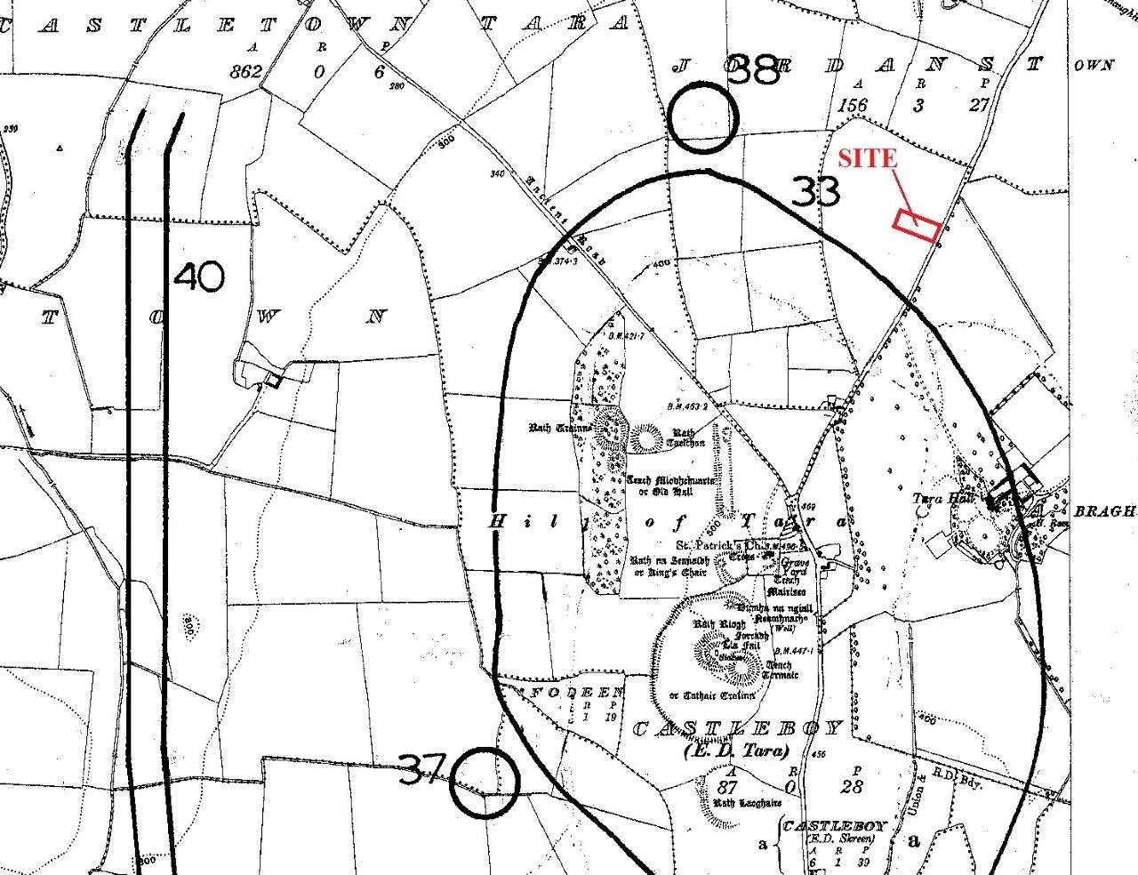
The site for a proposed single dwellinghouse was situated on the eastern flank of the Hill of Tara, c.150m north-east of the constraint area around the National Monuments comprising ME031-033 ‘Archaeological Complex’ on the summit of the hill. Monitoring had taken place in 1999 on the adjoining site to the north (Excavations 1999, No. 678).
Test trenches were excavated on 20 November 2015 as part of an Archaeological Impact Assessment submitted with a planning application to Meath County Council. On the recommendation of the National Monuments Service, a geophysical survey was carried out on the site and the immediately surrounding area. The survey, undertaken by J.M. Leigh Surveys under Licence 15-R-0106, reported that the background magnetic variation of the survey data was minimal and no clear archaeological pattern was evident.
Test trenches recorded a uniform picture of natural subsoil consisting of light brown sandy clay and small stones under 0.3-0.35m depth of topsoil with no archaeological material evident and no indication of any previous disturbance. Two sherds of earthenware of late-19th- or early-20th-century date, found in topsoil, were the only artefacts noted. The planning application was refused.