2015:619 - Broughanlea, Antrim
County: Antrim
Site name: Broughanlea
Sites and Monuments Record No.: MRA009:014
Licence number: AE/15/76
Author: Wes Forsythe
Author/Organisation Address: Centre for Maritime Archaeology, Ulster University
Site type: Salt works
Period/Dating: Modern (AD 1750-AD 2000)
ITM: E 713428m, N 941452m
Latitude, Longitude (decimal degrees): 55.207257, -6.217908
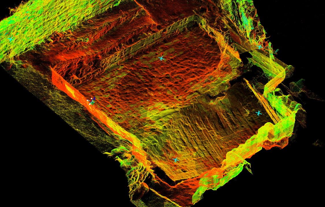
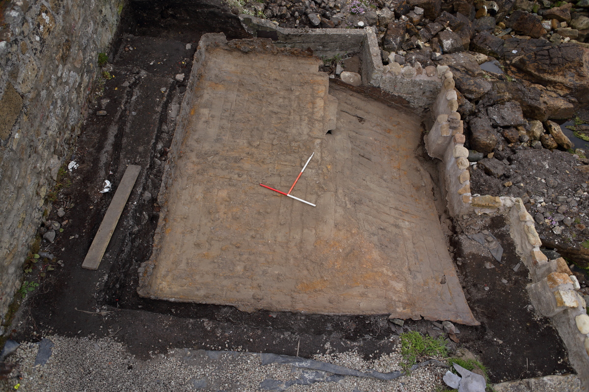
This site had been effected by storm action on the coast and was partially exposed showing damage to a relatively unique industrial survival. The excavation sought to remove the remaining overburden to fully expose and record (in situ) a wrought iron salt pan. Removal of the sod revealed a rich black layer of fine loamy earth containing a mix of modern finds including glass bottles, caps, metal fragments, slate, brick, ceramic and other domestic waste. Below this was a lighter brown loam containing less modern material and more building rubble – principally slate (some featuring nail holes), brick, and roughly dressed stone. The concentration of slate was particularly noticeable toward the wall to the west – obviously this formed the roofing material for the pans, which, as the roof deteriorated, slid down the remaining rafters in this direction. Some ceramics (white glazed and blue and white transfer printed) were also recovered from this context. Below this was the salt pan (5.13m x 4.84m x 0.4m). The pan comprised a series of riveted plates (0.6 – 40mm thick) forming a basin with a rim 0.4m high around the edges (surviving best on the west side, least to the east). The pan has been formed by a line of plates forming two cross members running across each other centrally dividing the pan into quarters. These quarters had been filled by plates being added to form successively smaller squares toward their respective centres. The rim of the pan was formed by a bent plate being added to the edge of the pan, and a further straight one added to gain height. The pan has split (north-south) due to the undermining action of the sea and the north-east portion has collapsed. Examination of the pan surface revealed that repairs had been made in the form of patches and bars. Boiling seawater in iron pans was very hard on the metal and the need for upkeep and maintenance is well documented.
Below the pan a portion of the furnace structure survived including three roughly dressed boulders which appeared to support the pan on the red brick furnace. The exposed section of walling appeared set at an angle (in plan view) relative to the direction of the pan edge, producing a flared opening to the furnace floor. This feature was likely a stoke hole for packing fuel (coal) underneath the pan. At its base was white deposit of ash on top of a tightly-packed row of beach cobbles representing the base of the fire pit. The cobbles contained ash and coal and were set in a bed of broken brick and mortar over deposits of coal and ash.
The size of the pan would indicate a later 18th-century date range.
Reference:
Forsythe, W. McConkey, R. & Breen, C. (2025) Coastal Saltworks and Atlantic Opportunities at Two Early Modern Sites on the North Coast of Ireland. European Journal of Archaeology 28 (4), 460-479.