2014:554 - DUNDONALD: Phase 2, Millreagh, Carrowreagh, Down
County: Down
Site name: DUNDONALD: Phase 2, Millreagh, Carrowreagh
Sites and Monuments Record No.: DOW 005:061
Licence number: AE/14/61
Author: Stuart Reilly, Gahan and Long Ltd
Author/Organisation Address: 7-9 Castlereagh Street, Belfast BT5 4NE
Site type: Burnt pit
Period/Dating: Undetermined
ITM: E 743774m, N 874154m
Latitude, Longitude (decimal degrees): 54.595183, -5.775067
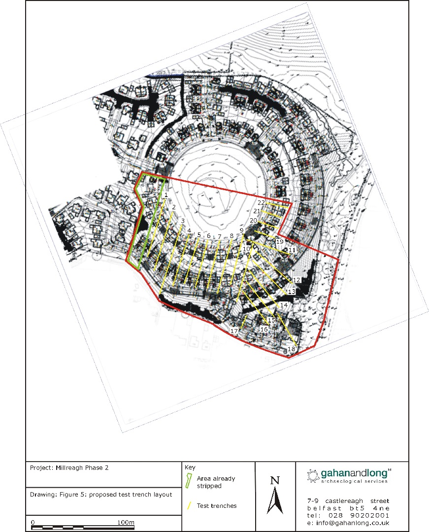
An archaeological evaluation was carried out prior to the construction of Phase 2 of a residential development at Millreagh, Dundonald. The proposed development site is located directly adjacent to a scheduled monument DOW 005:061, identified as a ring barrow.
A series of 22 test trenches were excavated across the site. The archaeological evaluation identified only very limited archaeological remains within this phase of the development. The majority of features consisted of randomly positioned pits of unknown function and date. Three features [7, 8 and 9] were found in close proximity to each other in Trench 12. Pit [7] contained charcoal-rich material and fragments of burnt bone. There was no evidence of burning within the base of the pit and it seems unlikely that a cremation was burnt here and instead this is probably a deposit of waste material from a cremation which took place elsewhere. Feature [8] appears to be the remains of a post-hole, however it is not possible to attribute any structural function to a post in this location. Finally, feature [9] represents a pit of unknown function. All three features are attributed as being contemporary on the basis of their proximity to each other rather than any stratigraphical relationship.
All identified archaeological features were fully excavated.