2014:547 - NEWRY: Lands adjacent to 60 Tandragee Road, Down
County: Down
Site name: NEWRY: Lands adjacent to 60 Tandragee Road
Sites and Monuments Record No.: DOW 046:025
Licence number: AE/14/212E
Author: Chris Long, Gahan & Long Ltd
Author/Organisation Address: 7-9 Castlereagh Street, Belfast BT5 4NE
Site type: No archaeology found
Period/Dating: N/A
ITM: E 708084m, N 830895m
Latitude, Longitude (decimal degrees): 54.215543, -6.342825
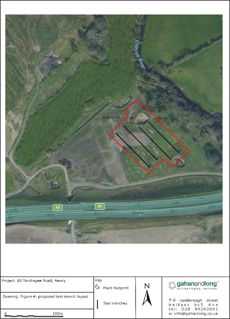
An archaeological evaluation was undertaken prior to the proposed construction of a dry fermentation plant at lands adjacent to 60 Tandragee Road, Newry, Co Down. One recorded site, DOW 046:025, is located within the proposed development site and is identified as an AP cropmark in the SMR.
4 test trenches across the footprint of the proposed development were excavated using a back-acting machine fitted with a toothless bucket. Trenches 1 and 2 were stopped slightly shorter than originally planned due to the presence of a quarry pit at their north-western ends.
No evidence of any archaeological deposits was identified during the course of the evaluation.