2014:545 - DUNDONALD: Lands to the north and east of 1097 Upper Newtownards Road and 1-7 Millmount Lane, Ballyoran, Down
County: Down
Site name: DUNDONALD: Lands to the north and east of 1097 Upper Newtownards Road and 1-7 Millmount Lane, Ballyoran
Sites and Monuments Record No.: N/A
Licence number: AE14/182E
Author: Chris Long, Gahan & Long Ltd
Author/Organisation Address: 7-9 Castlereagh Street, Belfast BT5 4NE
Site type: No archaeology found
Period/Dating: N/A
ITM: E 743903m, N 873817m
Latitude, Longitude (decimal degrees): 54.592121, -5.773238
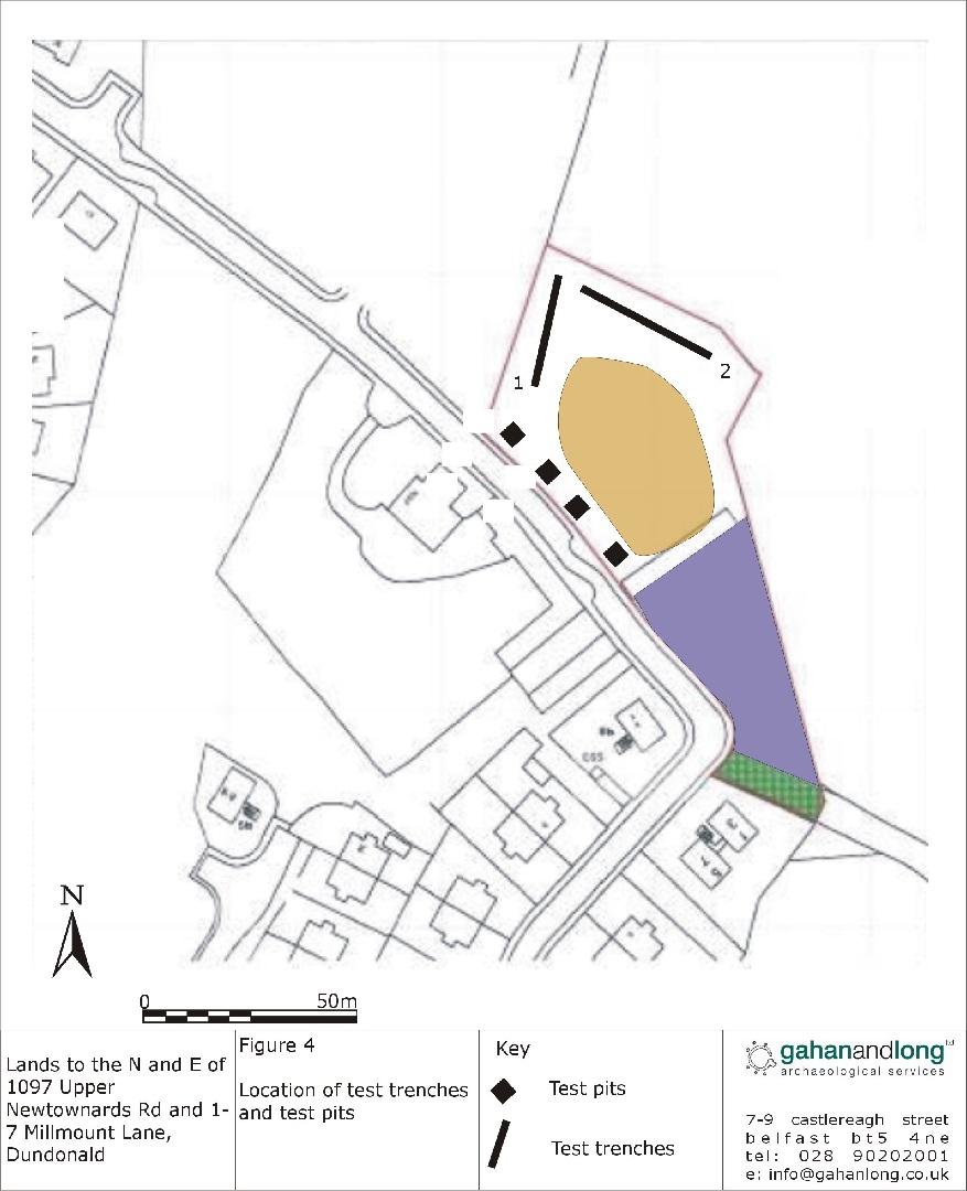
An archaeological evaluation was carried out prior to the proposed construction of a residential development on lands to the north and east of 1097 Upper Newtownards Road and 1-7 Millmount Lane, Dundonald.
The evaluation consisted of the excavation of 2 test trenches and 4 test pits. The central and southern areas of the site could not be tested due to the presence of a large spoil heap.
In both trenches a single layer of topsoil was removed, which had average depth of 0.3m, and directly overlay naturally occurring subsoil which was a compact orange glacial till
In all test pits a single layer of topsoil mixed with compacted hardcore material was removed to a depth of approximately 0.2m. This material gave way to naturally occurring subsoil which consisted of a compact orange glacial till.
No evidence of any archaeological deposits was identified during the course of the evaluation.