2014:578 - CASTOR BAY—BELFAST STRATEGIC TRUNK MAINS, Antrim
County: Antrim
Site name: CASTOR BAY—BELFAST STRATEGIC TRUNK MAINS
Sites and Monuments Record No.: N/A
Licence number: AE/14/52
Author: Stuart Reilly, Gahan and Long Ltd
Author/Organisation Address: 7-9 Castlereagh Street, Belfast BT5 4NE
Site type: Pit, Burnt spread and Hearth
Period/Dating: Multi-period
ITM: E 711028m, N 863942m
Latitude, Longitude (decimal degrees): 54.511722, -6.285378
An archaeological evaluation was carried out prior to the proposed construction of a strategic trunk mains from Castor Bay, Co. Armagh to Duneight, Co. Down. The trunk mains will extend from the existing Castor Bay Water Treatment Works, connecting through the Magheraliskmisk Reservoir, Co. Antrim, before terminating at the Duneight Reservoir, Co. Down. A further small section of the route was also monitored at Colin Glen Golf Course where the route extended for a short distance along the southern boundary adjacent to the Upper Dunmurry Lane and the Old Golf Course Road. The majority of the mains will be laid along existing roads, with only intermittent sections of the route extending through agricultural land.
Monitoring of topsoil removal took place over a period of several months in advance of construction. Topsoil removal was carried out by mechanical diggers fitted with toothless buckets. In general the corridor stripped for the development was on average 10m wide although in sections this narrowed to 5m.
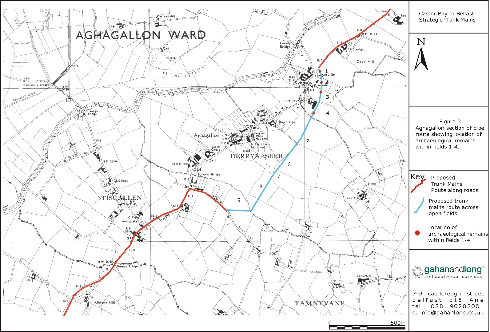
During the topsoil strip, 6 potential archaeological features were identified and marked off in Fields 1-4 at Aghagallon. In Field 1, a roughly oval shaped pit, containing a small piece of corroded metal and a small sherd of 18th-century Staffordshire salt glazed stoneware, was uncovered. In Field 2, a hearth was excavated containing many flecks of charcoal and pieces of burnt bright orange clay. In Field 3, a spread, with very frequent charcoal flecking and the occasional heat-fractured stone, and a pit containing heat-fractured stones, were identified in the hollow close to the stream. No artefacts were retrieved from either feature. In Field 4 a possible trough containing a small quantity of struck flint, and an elongated pit, were identified.
Two pits were uncovered in the section of the trunk mains cut along Colin Glen Golf Course. Both contained a single fill consisting of a moderately compact mid grey silty clay with occasional charcoal flecking. Both were fully excavated and no artefacts which could date these features were retrieved.
All features were archaeologically resolved prior to the laying of the mains.