2011:155 - CARNMEEN/LISDUFF, Down
County: Down
Site name: CARNMEEN/LISDUFF
Sites and Monuments Record No.: DOW046-026
Licence number: AE/11/59
Author: Johanna Vuolteenaho, Archaeological Development Services Ltd.
Site type: Excavation - miscellaneous
Period/Dating: Multi-period
ITM: E 707684m, N 830024m
Latitude, Longitude (decimal degrees): 54.207800, -6.349270
The site is located on the north-eastern outskirts of Newry and is bounded by the Newry River to the west, the Cloghanramer Road to the east and the Carnbane Industrial Estate to the south. The site consisted of two adjoining fields, with the total area measuring approximately 600m west–east by 625m, comprising approximately 44.3ha.
The proposed development site lies within an archaeologically sensitive area, with 28 recorded sites within a 1.5km radius. One of these sites, a possible enclosure (DOW046-026) identified from an aerial photograph, is located within the boundaries of the proposed development. Prior to the 2011 phase of archaeological investigations the site had been subject to two comprehensive evaluations, carried out in 2009 by Warren Bailie and in 2010 by Warren Bailie and Vincent McClorey (ADS Ltd) (Excavations 2009, no. 238, AE/09/136; Excavations 2010, no. 238, AE/10/34). The evidence collated from the evaluation works indicated an extensive, though dispersed, archaeological landscape, dating from the Bronze Age period (1500–500 BC).
Further investigations were carried out on the site of the Carnbane Industrial Estate from May to August 2011. A total of 48 areas were topsoil-stripped, targeting the archaeological deposits previously identified during the preceding evaluation phases. Among the features previously encountered were four fulachta fiadh areas, two enclosures, a ring-ditch and cremations, as well as pitting activity and evidence of structural elements in the form of post-holes. The first phase of the investigation comprised resolution of those features. Additional features were encountered during the investigation works, and selected areas were resolved under the same licence number between July and August 2011. The chronological range for the excavated features is likely to span from the Neolithic to the early medieval period. Whilst several of the isolated features turned out to be later, post-medieval, in date, the majority of the features are likely to date from the Bronze Age. Specialist analysis, including radiocarbon dating, is needed to confirm and refine the dating of the archaeological activity.
The areas fully resolved include Areas 16, 28 and 21–22/24, which were areas of burnt mound/fulacht fiadh activity. In Area 16 this activity comprised two concentrations of burnt mound material built up over peat deposits. The peat had formed over a series of alluvial and water-laid deposits indicative of a possible pond and a watercourse. Several split, partially hollowed-out tree trunks were encountered within the peat layers. A stash of split timbers and planks, possibly meant for use as firewood, was also encountered. In addition, several troughs associated with the burnt mound activity were recorded. The earliest trough was subcircular in shape and had wooden stakes at the base. The later troughs were increasingly more rectangular in shape.
The burnt mound areas in Area 28 and Area 21–22/24–26 were much drier and not waterlogged like Area 16. Troughs and pits associated with burnt mound activity were recorded here also. A substantial pit containing prehistoric pottery was also excavated in Area 21–22/24–26.
Area 46, measuring approximately 130m by 95m, was located within the northern half of the southern field. An extensive Bronze Age cremation burial complex, comprising ring-ditches and cremations along with associated features such as post-holes indicative of funerary markers, was excavated.
The area revealed an extensive ring-barrow cemetery of likely Bronze Age date. A total of 39 cremations and over 300 further features were excavated within the area. Several phases of burial activity were identified, based on the stratigraphic sequence of intercutting features. At the time of writing, however, the pottery and other datable finds had not yet been processed by the relevant specialists, and therefore no definite dates for the finds have been assigned.
The earliest phase of the cemetery appears to consist largely of single cremation burials in pits. Many of the cremation pits appear to be associated with post-holes. It is likely that the associated post-holes represent funerary markers and that the locations of cremation burials would have been visible above ground, at least for some length of time.
The subsequent phase of the cemetery is associated with the construction of large burial monuments. Six definite ring-ditches were excavated, ranging from 2m to 7m in diameter. In addition, the severely ploughed-out remains of a possible seventh ring-ditch were recorded. Three of the ring-ditches contained associated cremation pits. The cremations associated with the rest of the ring-ditches appear to have been lost, however, probably owing to horizontal truncation caused by ploughing. In most cases the bases of the ring-ditches were filled/lined with stones. Concentrations of stone scatters are also visible in the area surrounding the ring-ditches. The abundance of stones is likely to be the result of stone mounds/barrows associated with the cremation burials being ploughed into the surrounding landscape.
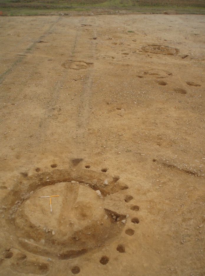
No. 155. Carnmeen/Lisduff: ring-barrow cemetery.
Two of the ring-ditches were larger than the rest. One of these, ring-ditch 649, measured 7m in diameter (4m in internal diameter). Its earliest phase was associated with an external timber circle consisting of nineteen upright timber posts. Upright stone pillars were also encountered along the inner edge of the ditch. The base of the ditch was stone-lined and that, along with the upright stones, would likely have added a striking visual effect to the monument. The monument appears also to have had a longer lifespan, as the ring-ditch was clearly recut, but by that time the timber circle appears to have already fallen out of use.
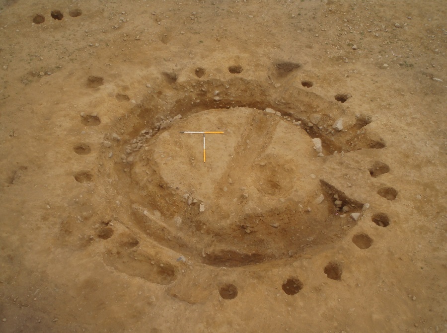
No. 155. Carnmeen/Lisduff: ring-barrow cemetery, ring-ditch 649.
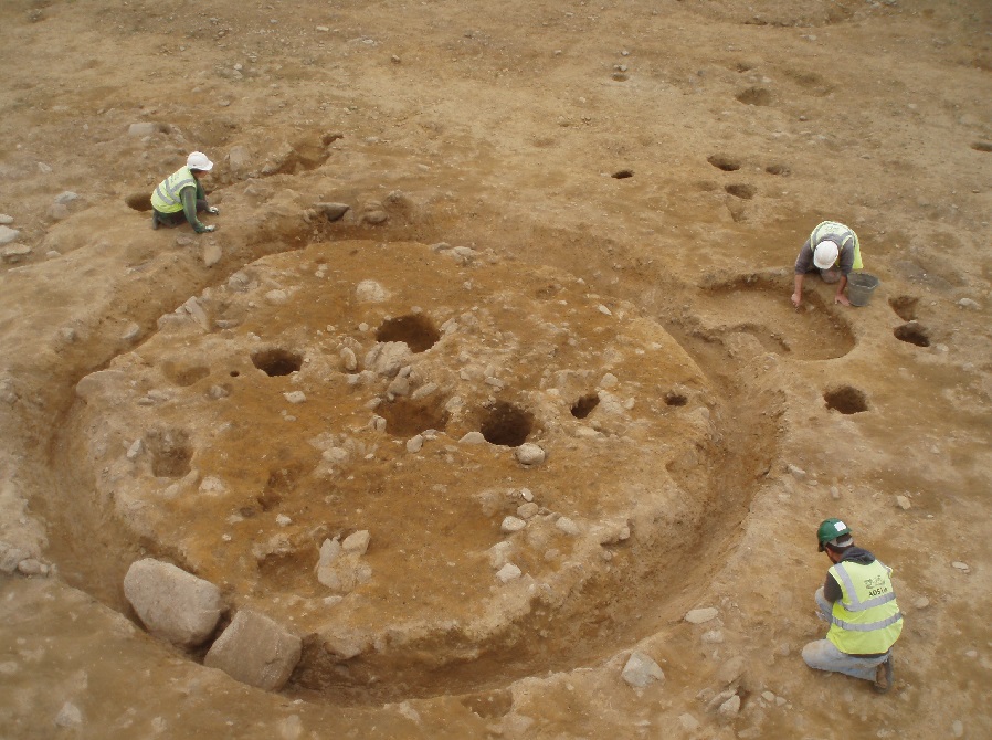 No. 155. Carnmeen/Lisduff: ring-barrow cemetery, second large ring-barrow.
The second large ring-barrow was similar in size and truncated two earlier cremation pits. Cremations as well as post-holes within the centre were recorded. These may be associated with the ring-ditch, although radiocarbon dating is needed to confirm whether they are indeed contemporary. In addition, a later cremation had been deliberately inserted into the ditch fills, suggesting that the monument would still have been visible in the landscape at the time.
Additional cremation pits were also identified. Prehistoric pottery associated with several of the pits has been encountered. In addition, several cremation pits showed evidence of deliberate stone lining, and one pit even had a flat stone base. It has been suggested that the stone lining and base symbolise the presentation of a cremation vessel.
A series of curvilinear enclosing ditches and post-holes seemingly associated with the ditches appear to form the eastern edge of the later monument-building phase of the cemetery. No ring-ditches have been identified to the east of the ditches, but several cremation pits, likely associated with the earlier phase, were recorded in the area. Furthermore, circular pits containing remains of prehistoric pottery vessels may represent funerary offerings.
Clusters of large pits (approximately 1m in diameter), many filled with possible packing stones, were recorded within the area of the cemetery. These were interpreted as large post-pits, possibly for substantial upright timbers such as totem posts. Alternatively, it is possible that they could have contained upright standing stones, similar to the collapsed standing stone encountered to the west of the cemetery.
The collapsed standing stone is likely to have been associated with the cremation cemetery. No cremations were encountered to the west of the standing stone.
The severely ploughed-out remains of a curvilinear enclosure were identified to the west of the burial activity. The surviving extent of the enclosure ditch was approximately 45m in diameter and may represent a slot for some form of timber palisade.
Features associated with domestic activity were encountered to the west of the cemetery and comprise, among other features, a kiln with upright stone pillars and a flat stone lid. Clusters of post-holes indicative of small structures were also excavated.
In addition, several seemingly isolated features were excavated. Several of these turned out to be later, post-medieval, in date. The majority of the features, however, are likely to date from the Bronze Age, although specialist analysis, including radiocarbon dating, is needed to confirm and refine the dating of the archaeological activity.
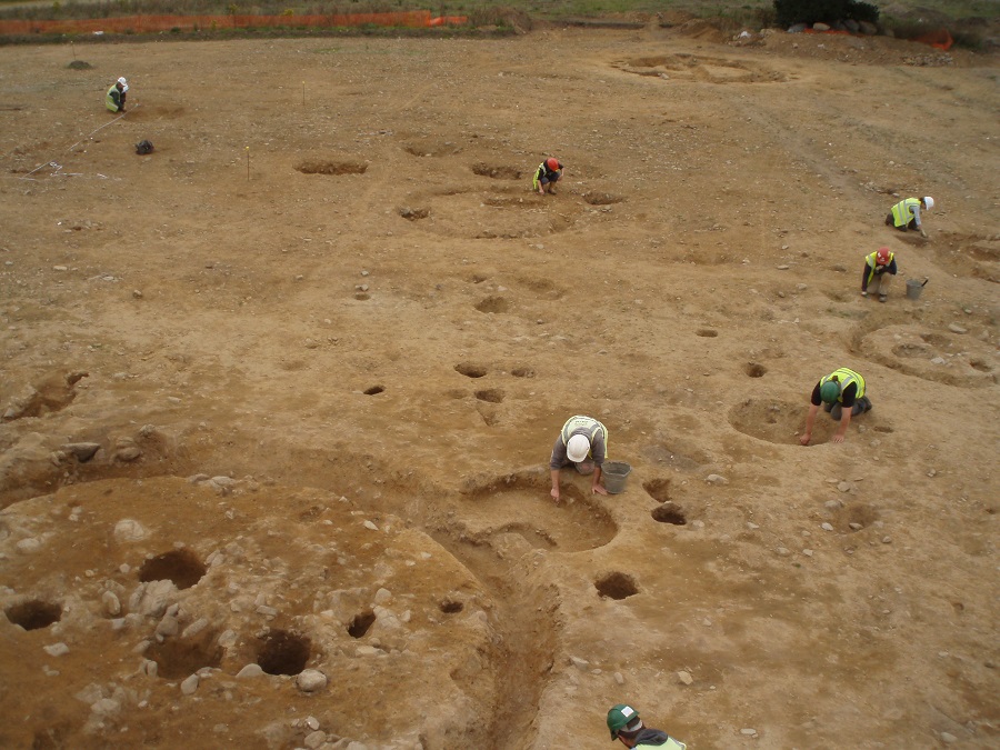
No. 155. Carnmeen/Lisduff: excavation in progress, looking north-north-east.
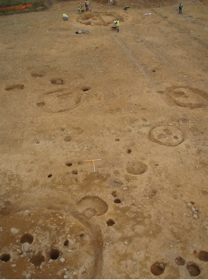
No. 155. Carnmeen/Lisduff: aerial view of site, looking north-north-east.
