2010:772 - KILCANNON (2), Wexford
County: Wexford
Site name: KILCANNON (2)
Sites and Monuments Record No.: N/A
Licence number: E004284
Author: Bruce Sutton, for TVAS (Ireland) Ltd.
Author/Organisation Address: Ahish, Ballinruan, Crusheen, Co. Clare
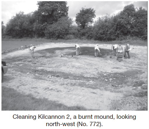
Site type: Burnt mound
Period/Dating: Undetermined
ITM: E 698868m, N 642934m
Latitude, Longitude (decimal degrees): 52.528784, -6.542881
Kilcannon 2 was located on the proposed M11 Gorey to Enniscorthy scheme. The site was located in grassland which slopes gradually at the eastern side. It is steeper to the west and levels out towards the Kilcannon Stream, situated at the western side of the field.
Kilcannon 2 consisted of a classic ‘horseshoe-shaped’ burnt mound measuring 14m by 13.9m with a maximum depth of 0.8m. The central trough, which measured 3.2m by 1.4m and was 0.52m deep, was rectangular in shape with a timber frame. The timber frame comprised two side planks, two end planks, two base planks and two supporting timbers. The side planks had lap joints at either end, as did the end planks. The end planks had been displaced after use but would have slotted into the side planks joints. The two base planks had unused lap or tenon joints at the northern end, which suggests that they were reused from elsewhere. Natural clay had slumped over the side and end planks prior to post-use infilling of the trough.