2010:223 - MILLMOUNT: Coopers Land, Down
County: Down
Site name: MILLMOUNT: Coopers Land
Sites and Monuments Record No.: N/A
Licence number: AE/10/050
Author: Robert M. Chapple, Northern Archaeological Consultancy Ltd.
Author/Organisation Address: 638 Springfield Road, Belfast, BT12 7DY
Site type: Milling complex
Period/Dating: Modern (AD 1750-AD 2000)
ITM: E 742702m, N 872685m
Latitude, Longitude (decimal degrees): 54.582298, -5.792355
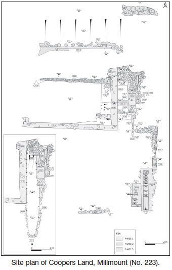
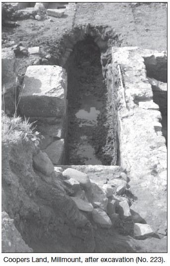
Work continued at the site of Coopers Land, Millmount, Dundonald, with the excavation of the 17th- to early 20th-century mill. The excavation revealed that there had been three successive phases of construction of the mill. Phase 1 consisted of a single rectangular building with a large water wheel, wheel pit and mill-race. During Phase 2, extension of the mill building and culverting of the mill-race took place. In Phase 3, further extension of the building, removal of the water wheel and closing up of the original wheel pit and the construction of a small wheel and pit to the south happened. Although the valuation maps indicate that the mill was initially a corn mill it is believed that by the early 20th century it was used for scutching flax.