2009:882 - BAUNMORE BOG, Tipperary
County: Tipperary
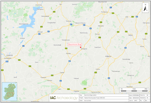
Site name: BAUNMORE BOG
Sites and Monuments Record No.: TS036-050
Licence number: 09E0294
Author: Jane Whitaker & Nicola Rohan
Author/Organisation Address: c/o IAC Ltd, Unit G1 Network Enterprise Park, Kilcoole, Co. Wicklow
Site type: Road-Class 1 togher
Period/Dating: Early Medieval (AD 400-AD 1099)
ITM: E 625211m, N 664191m
Latitude, Longitude (decimal degrees): 52.728223, -7.626757
Archaeological excavations took place at Inchirourke townland in Baunmore Bog, co. Tipperary (South). The site was excavated under the licensee Nicola Rohan then of Archaeological Development Services (ADS).
This site was identified as a ‘single plank trackway’ (Road-Class 1 togher) during the Peatland Survey 2006 and was dated to AD 753 ±9. It was orientated north-east to south-west and was traced for 690m across the south-eastern end of Baunmore Bog. It is composed of longitudinally laid planks with transverse supports.
Four cuttings were excavated in proximity to the centre and both ends of the trackway.
Cutting 1 was oriented north-east to south-west and measured 10m by 4m.
The togher was composed of longitudinally laid planks (5.72m-Length, 0.19-0.54m width) and roundwoods (0.9-6.67m length, 0.08-0.16m diameter) laid side by side (up to four elements wide).
They were underlain, at regular intervals, by transversely laid roundwoods (three, measuring 0.9-2.3m length, 0.07-0.18m diameter) and planks (five, 1.43-2.32m length, 0.16-0.25m width, 0.05m-0.18m depth).
Additional support was provided by seventeen substantial pegs (0.54-1.92m length) that were laid either side of the longitudinal elements, to prevent them from slipping laterally. Small clusters of brushwood were laid either side of the longitudinal elements.
Cutting 2 revealed a disturbed section of the trackway. While the majority of the pegs (29) remained in situ, only a small number of longitudinal and transverses remained in situ. At this location the trackway measured 1.2-2.8m in width and 0.05-1.03m in depth.
A small brushwood platform was located on the southern side of the trackway, at the centre of the cutting. Oriented north-south. A number of brushwood elements on the northern side of the platform ran beneath a longitudinal roundwood. This indicates that the platform was laid prior to the trackway. It may have been constructed as a platform for use during the construction of the trackway.
Cutting 3. All that survived of the trackway was a small number of fragmented longitudinal roundwoods and a single plank, roundwood transverse elements and nineteen pegs. In Cutting 3, the trackway measured 0.75–2.05m in width and 0.03–0.4m in depth.
Cutting 4. At this location, the site measured 1.87–4m in width and 0.09–0.3m in depth.
The upper surface of the trackway was dominated by a single large plank that measured over 6m in length. Parallel roundwoods ran either side of the plank to provide a stable surface to the trackway. Six supporting transverse elements were recorded within the cutting including two planks and four large roundwoods.
The togher continues across the county boundary into Islands townland in Co. Kilkenny (KK012-081—-). The plank and roundwood Road-Class 1 togher was orientated north-east/south-west between the dryland island in Inchirourke to the west, and the dryland to the east in the Islands townland. Composed largely of ash, the most common evidence for wood working included wedge ends. Facets were large and flat, with a minimum blade width of 70mm (suggesting strong, sharp tools), while the use of mallets and possible adzes is also suggested.
One wood sample was submitted for dendrochronological dating; analysis indicated that the tree-ring series dates from AD 539 to AD 746, with the best estimated felling date range for the tree AD 753 ± 9 years.
Please see final report: Whitaker, J. and Rohan, N. 2019. Final Excavation Report for Baunmore Bog (Licences: 09E0294, 09E0295, 09E0296), Irish Archaeological Consultancy Ltd., 2019. Unpublished report prepared by IAC Archaeology.