2009:637 - BECTIVE, Meath
County: Meath
Site name: BECTIVE
Sites and Monuments Record No.: ME031-026
Licence number: E4028, C353; R180
Author: Geraldine Stout, Chapel Road, Julianstown, Co. Meath.
Author/Organisation Address: —
Site type: Religious house - Cistercian monks
Period/Dating: Medieval (AD 400-AD 1600)
ITM: E 686301m, N 759716m
Latitude, Longitude (decimal degrees): 53.580224, -6.696749
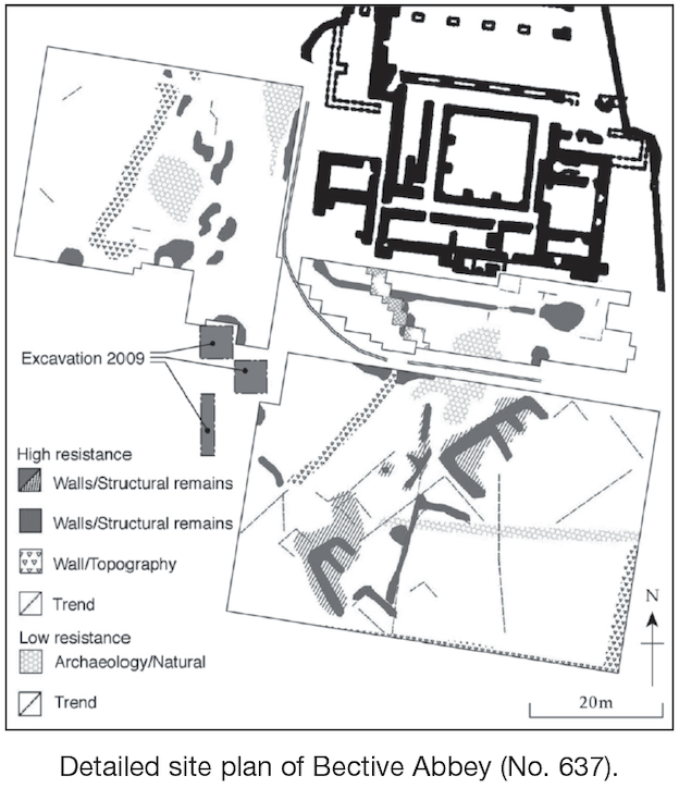
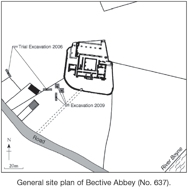
A research excavation was carried out within the southern precinct of Bective Abbey, Bective, Co. Meath, in July 2009. The site is located c. 0.7km south-east of the village of Bective and c. 6km southwest of Trim. Bective Abbey is a national monument (ME031–026). Excavation over four weeks revealed two main phases of activity of medieval and post-medieval date, the former represented by the southwestern corner of a building with an external drain and enclosed by a medieval ditch and the latter represented by a demolition event, erection of a property boundary and a single burial of human remains.
Prior to excavation, a topographical survey revealed the remains of what appeared to be a rectilinear enclosure that lay west and south-west of the abbey remains. It was defined by a platform and external ditch, which had a maximum length of c. 56m east to west by c. 53m. In the south it had been damaged by both a post-medieval property boundary that runs on a roughly east–west axis and the demolition of a building that is marked on the first-edition OS map, foundations of which still survive. The enclosure was defined in the west by a narrow bank or collapsed wall that connects with the present boundary wall at the west end of the nave of the abbey church. This bank also forms one side of a trackway, which is shown on the first-edition 6-inch OS map to run from a former entrance off the main Trim road in a north-north-westerly direction. This provided access to a number of buildings that are indicated on the first-edition 6-inch OS map. The topographical survey suggested that the north-eastern quadrant of the enclosure may underlie the medieval abbey and therefore be the earliest known structure on the site. It was postulated that further investigation of this rectilinear enclosure would provide evidence for the initial foundation of the Cistercian abbey in the 12th century.
The excavation revealed that the rectilinear enclosure is a post-medieval creation resulting from the juxtaposition of a disused trackway and a 17th century property boundary. The area enclosed was artificially raised when the debris resulting from the demolition of masonry buildings was spread across the site, probably in the 17th century. However, what was most significant about this demolition layer is that it sealed valuable archaeological deposits and structural features, which provide tangible evidence for medieval use of the precinct during the lifetime of Bective Abbey. Excavations exposed the south-western corner of a building with an external drain and enclosed by a medieval ditch. The drain, which runs along the outside of its south wall, produced an array of medieval pottery, oyster shells and animal bones, which provide an important clue as to the probable function of this building as the monastic infirmary. Tangible evidence for infirmaries within the precincts of Irish abbeys is rare; two possible examples have been identified in Co. Tipperary at Holy Cross and Kilcooly. This highlights the significance of the Bective findings and the necessity to fully investigate this structure in a future programme of excavation. Results of the remote survey and topographical survey at Bective have also identified numerous areas of archaeological potential within the abbey precinct, where the remains of medieval outbuildings may still exist and have been pinpointed for further investigation.