2009:331 - DUBLIN: Wood Quay/Winetavern Street, Dublin
County: Dublin
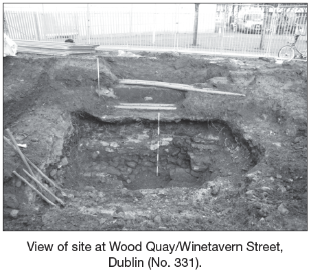
Site name: DUBLIN: Wood Quay/Winetavern Street
Sites and Monuments Record No.: DU0180–020 C329
Licence number: ext.; E4058
Author: Linzi Simpson, Margaret Gowen & Co. Ltd.
Author/Organisation Address: 27 Merrion Square, Dublin 2
Site type: Historic town
Period/Dating: Multi-period
ITM: E 715103m, N 734053m
Latitude, Longitude (decimal degrees): 53.344168, -6.271396
Testing was carried out along the line of the c. 1100 city wall at Wood Quay, at the Winetavern Street end. The testing was carried out to establish the exact line of the wall, with regard to the proposed DART underground project. The city wall was first exposed during the large-scale excavations at John’s Lane East, Winetavern Street, Fishamble Street and Wood Quay, in the 1970s and 1980s. This stretch of wall, which originally encircled the entire Hiberno-Norse settlement of Dublin, is still extant in the basement of Block 1, measuring over 30m in length by 4m in height. It survived demolition in the post-medieval period, as it was incorporated into buildings in the 18th century, and this can be traced in the cartographic sources, most notably Rocque (1756). This extant stretch lies just 18m to the east of the site under discussion.
The assessment did locate the city wall but revealed that a post-medieval cellar wall was constructed immediately on top of the wall and it had been reduced in width as a result, the stone robbed-out for later walls. It was located c. 2.3m below present ground level but only the upper level and southern face were exposed, as the post-medieval wall was left in position. The wall probably extends for a further 2.3m in depth at this location, based on the levels from the exposed section further east. In general, the wall was identical to the extant section further east, where it was found to have a rubble core faced with large limestone blocks. The position of the new section was fully recorded on CAD and by scaled survey, but the wall was not fully exposed and the cellar wall not removed, to prevent damage in the future.
The excavation also established that there were archaeological remains in position in this location, which were not removed as part of the general archaeological campaign of Wood Quay of the 1970s and early 1980s. These remains consisted of at least one 18th-century brick cellar, which was built over the line of the city wall in this location, presumably sealing medieval layers beneath. The upper levels of the city walls were demolished to facilitate this new cellar build and the city wall stones were robbed out and reused in the 18th-century cellar. A small investigation was carried out on the northern side of the city wall and this established that there were archaeological deposits in situ on this side, also most likely to be 18th-century cellars. These also presumably seal medieval deposits beneath.