2009:330 - DUBLIN: Civic Offices, Wood Quay, Dublin
County: Dublin
Site name: DUBLIN: Civic Offices, Wood Quay
Sites and Monuments Record No.: DU0180–020
Licence number: C251 ext.; E3831
Author: Linzi Simpson, Margaret Gowen & Co. Ltd.
Author/Organisation Address: 27 Merrion Square, Dublin 2
Site type: Historic town
Period/Dating: Multi-period
ITM: E 715142m, N 734047m
Latitude, Longitude (decimal degrees): 53.344108, -6.270811
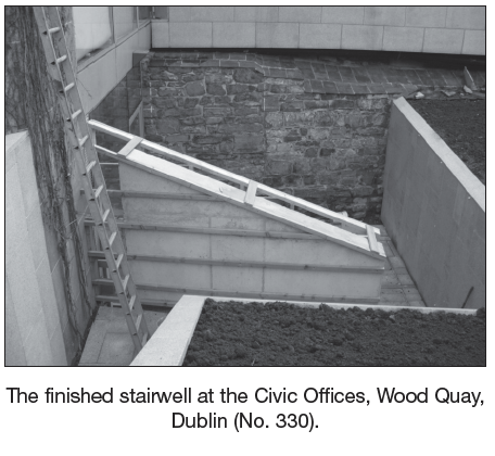
Monitoring was carried out of recent works in the basement of the Civic Offices at Wood Quay (Block 1). The project involved the refurbishment of the derelict basement, which contains a stretch of the c. 1100 Hiberno-Norse city wall, first exposed during the Wood Quay excavation in the 1980s. While part of the wall was demolished during this campaign, a significant stretch still survives, both within the basement (22m in length by 3.5m in height) but also extending out of the building on the western side (9m east–west by 4.2m in height). The wall was fully surveyed in advance and all works were monitored during the refurbishment, which was carried out under the supervision of Carrig Conservation (Simpson and Acinelli 2008). The new works also involved the construction of a new external stairwell/ fire access route on the western side of Block 1, where the external stretch of the wall was on display.
The construction of the stairwell necessitated a reduction in the ground level outside the basement. This area was a large graded back void, which allowed light into the basement window of this side. The works included removal of part of that graded bank on the western side, which exposed more of the city wall. An additional four courses were exposed in a stretch that measured 7m east–west and this was found to be a plinth, which was 1m in height and founded on boulder clay. The programme of works also exposed a number of underpin trenches from the 1980s which involved the removal of some of the facing stones of the plinth and the insertion of concrete. Unfortunately, at the western end of the wall, this work had not been completed and a series of voids were exposed. This uncompleted work caused horizontal cracking in the facing stones of the wall (the core of the wall is a rubble core) and there were fears about the general stability of the plinth. As a result, a series of new underpin trenches were devised to support the wall in this location and this involved the excavation of the voids (which produced modern rubbish including Tayto crisp packets).
The discovery that the wall was compromised at foundation level prompted a rethink on how the western side of the stairwell was to be supported. While the exposed section of the wall was underpinned, it is not known how far west the problem continues, although it is probably unlikely to extend much further, as the underpinning strategy of the 1980s was probably always confined to close to the basement structure. In addition to this, more recent excavations, located 18m to the west, have revealed that the city wall in this location was never exposed in the 1980s and is incorporated within existing 18th-century cellars (see No. 331, Excavations 2009). The result was the decision not to expose any more of the city wall, despite the fact that it was required for the construction of the retaining west wall of the stairwell, orientated north–south. Instead, this wall was shifted further east to reduce the amount of space required for enabling works. While this unfortunately resulted in a loss of visible wall, the wall is now in a far more stable condition.
References
Simpson, L. and A. Acinelli. 2008 Measured survey of the city wall of Dublin: sections of the city at Lamb Alley, Power’s Square and Cook Street, Dublin city. Also includes a section at Wood Quay in the basement of Dublin Civic Office.
Simpson, L. 2008 Report on monitoring works at the city wall, in the basement of the Dublin Civic Offices, Dublin 2 (ministerial consent: C251 (W27).