2008:852 - LISNAWULLY, Louth
County: Louth
Site name: LISNAWULLY
Sites and Monuments Record No.: LH007–035
Licence number: 08E0978
Author: Kieran Campbell
Author/Organisation Address: 6 St. Ultans, Laytown, Drogheda
Site type: Possible Souterrain site
Period/Dating: Early Medieval (AD 400-AD 1099)
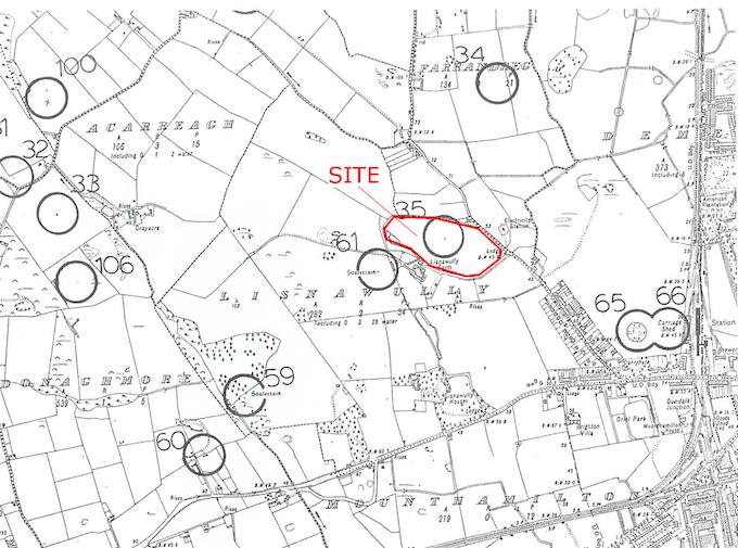
ITM: E 703159m, N 807311m
Latitude, Longitude (decimal degrees): 54.004714, -6.426351
Test-trenching took place in December 2008 in advance of a planning application for a housing development in the ‘Doctor’s Field’ on Lisnawully Farm, Mount Avenue, Dundalk, Co. Louth. The testing was principally concerned with the presence on the site of LH007–035, ‘souterrain’, and also with further possible archaeological features identified in a geophysical survey carried out by Earthsound Archaeological Geophysics. The Doctor’s Field is zoned residential in the draft Mount Avenue Area Masterplan, drawn up by Dundalk Town Council, with a distributor road running north–south across the western side of the field. The Masterplan was deficient in relation to the known archaeological sites within the plan area and omitted several recorded monuments, including the souterrain in the Doctor’s Field.
Geophysical surveys had been conducted on the two topographical high points in the field which included the small hill where souterrain LH007–035 is indicated in the RMP. The surveys detected two possible souterrains, one in the general vicinity of the known monument and the other downslope to the west, although in both instances a geological cause for the anomalies was not ruled out. Other possible archaeological features detected were possible curvilinear ditches and areas of burning.
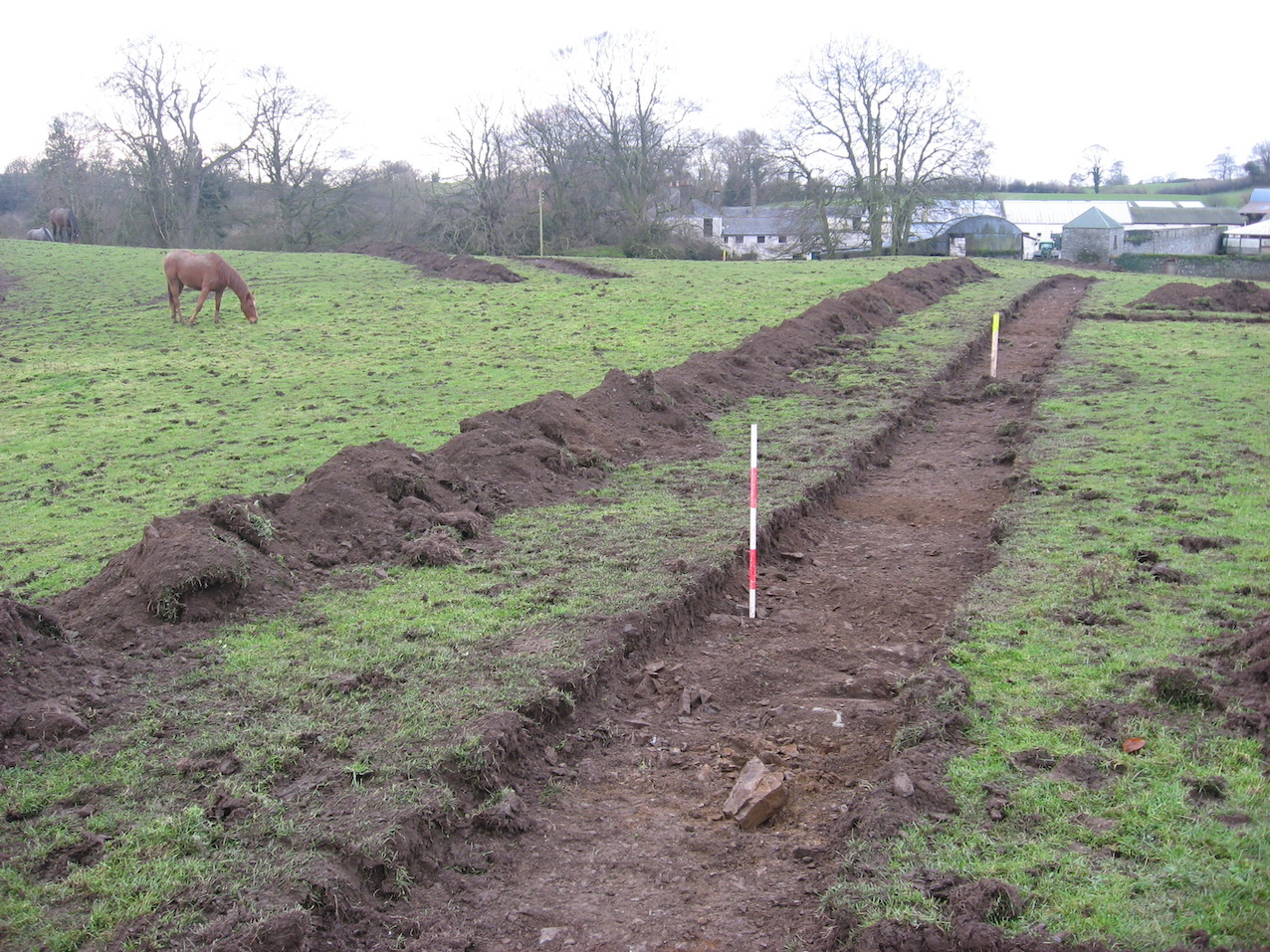
Test-trenches with a total length of 420m were excavated by a small tracked machine. The various anomalies detected in the geophysical survey were caused by outcropping bedrock and no archaeological features or other evidence of previous disturbance was found. At the location given for souterrain LH007–035, bedrock was encountered within 0.2m of the ground surface (marked by ranging rod in attached photograph). An examination of the files in the archives of the National Monuments Section, DEHLG, indicated that all the cartographic and documentary sources refer to a souterrain to the west of Lisnawully Farm, LH007–061, 250m distant, and not to a souterrain in the Doctor’s Field.