2008:637 - TRALEE: Abbey Carpark, Kerry
County: Kerry
Site name: TRALEE: Abbey Carpark
Sites and Monuments Record No.: KE029–119
Licence number: C225; E3455
Author: Frank Coyne, Aegis Archaeology Ltd.
Author/Organisation Address: 32 Nicholas Street, Kings Island, Limerick
Site type: Religious house – Franciscan friary
Period/Dating: Medieval (AD 400-AD 1600)
ITM: E 483454m, N 614350m
Latitude, Longitude (decimal degrees): 52.268485, -9.707589
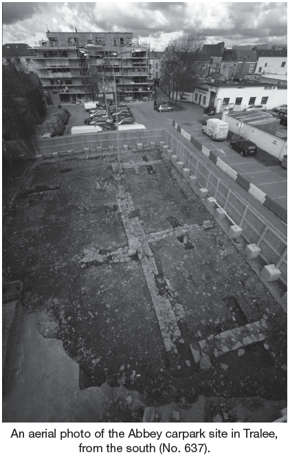
This area, which was the subject of test excavations, was located on the site of the medieval Dominican priory of the town and lies within the zone of archaeological potential for the medieval town of Tralee. The subject site was a plot measuring 26m2 at the southern end of the Abbey carpark, Tralee. Testing was undertaken in order to assess the full archaeological potential of the area as part of a proposal to construct a museum on the site.
The trenching identified the ground plan of buildings, probably relating to a southern projection of the east range of the monastery. The walls uncovered show what is now presumed to be the southern end of the eastern range of the Abbey cloister. They all survive to an average height of c. 1m, and this consistency in height would indicate that the Abbey walls were systematically levelled, as previous evidence has suggested.
Human remains were also uncovered on the site. Three burials were excavated and two further grave-cuts were noted as being cut into the natural clay. There appear to be distinct phases of burial on the site. It was noted that, while some skeletons have been buried into the underlying natural clay and are probably dating to the medieval period, some appear to be later, as they have been buried into a layer built up of humic material and may therefore date to the period post-dating the destruction of the abbey itself. Some ex-situ architectural fragments were also recovered during the test excavations.