2007:1322 - GRANGE (3), Meath
County: Meath
Site name: GRANGE (3)
Sites and Monuments Record No.: N/A
Licence number: A029/005, E3123
Author: Amanda Kelly, Irish Archaeological Consultancy Ltd.
Author/Organisation Address: 120B Greenpark Road, Bray, Co. Wicklow
Site type: Field boundary, Kiln - corn drying, Ring-ditch and Metalworking site
Period/Dating: Multi-period
ITM: E 680719m, N 769948m
Latitude, Longitude (decimal degrees): 53.673040, -6.778365
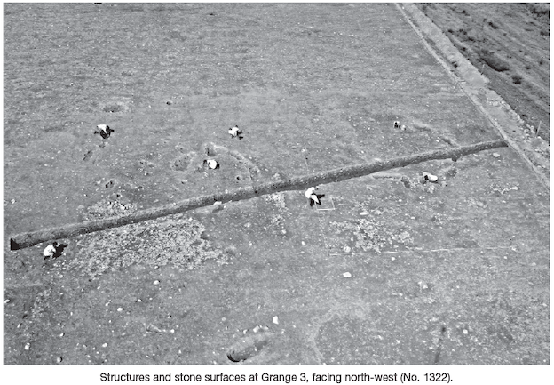
This site was located within Contract 4 (Navan–Kells and Kells bypass) of the M3 Clonee to North of Kells motorway scheme and was identified during testing carried out by Jo Ronayne (IAC Ltd) in 2004 (Excavations 2004, No. 1245, 04E0925). It was excavated between 26 June 2006 and 26 January 2007 and represents an excavated area measuring 250m by 85m. Two Bronze Age house structures and their associated ‘outdoor’ cobbled working areas were located in the eastern area of the site. Each structure comprised a series of interrupted pits, forming a circle, flanked internally by a circle of post-holes, spaced c. 2m apart. All of the features yielded evidence of intense burning. One such perimeter pit yielded a large stone adze (230mm long) which had been reused as a percussion implement (i.e. a hammer). A large saddle quern and a spherical rubbing stone were also found in pits along the perimeter of Structure 1.
The associated compacted stone surfaces represent outdoor working areas and yielded evidence suggesting that they were specialised work areas. The lithic assemblage retrieved from the clay deposit covering one such compacted stone floor consisted almost exclusively of worked chert (together with a high quantity of ceramic material), while a separate stone floor yielded exclusively worked flint (again, accompanied by a quantity of ceramic material) and also contained an in situ saddle quern. A small burnt pit underneath another compacted stone floor contained a perforated and scored stone object, probably a pendant.
Four cremation pits were located in the outlying area of the structures, one of which yielded another spherical rubbing stone, identical to that found in a perimeter pit of Structure 1. Four substantial figure-of-eight-shaped kilns were located throughout the site. These features are probably early medieval cereal-drying kilns.
Both a house-structure pit and a compacted stone floor were cut by circular pit furnaces. Seven examples were identical in both their size and their sequence of burnt fills, while three contained slag; moreover, there were numerous smaller features which might also be attributed a similar function. An impressive kiln, complete with ceramic furnace bowl, was located in the adjacent excavation (Grange 2, No. 1321, Excavations 2007, A029/006). It is possible that the circular pit furnaces in Grange 3 are associated with the large furnace kiln in Grange 2. The distance between the two sites is 21m.
Located in the far western extent of Grange 3 was a substantial ring-ditch, with an external diameter of 16.5m. At the top of the ditch its width was 3.25–4m. The western section of the ditch yielded charcoal-rich fills containing burnt bone and flint scrapers. The lowest/primary fill of the ditch contained high quantities of antler, horn and animal bone. A compacted stone fill was located in the centre of the ditch, forming a continuous stony seam within the ditch. The interior area enclosed by the ditch had a diameter of 9.5m and contained four substantial post-holes (or small pits).
To the east of the ring-ditch, irregular, yet substantial, linear ditches were located. One such ditch, running east–west and tapering out to the east, yielded a ring-pin in its upper fill. This ditch was truncated by a second ditch, running north–south, and was effectively blocked by a low stone wall.
Four major groups of activity can be identified on the site: Bronze Age house structures (and their associated outdoor cobbled working surfaces and outlying cremations), early medieval field boundary/land division ditches and cereal-drying kilns, a ring-ditch or barrow, and a series of metalworking features.
This work was funded by Meath County Council and the National Roads Authority.