2007:2070 - TENTERS BLACKPITTS, Dublin 8, Dublin
County: Dublin
Site name: TENTERS BLACKPITTS, Dublin 8
Sites and Monuments Record No.: N/A
Licence number: 07E0702
Author: James Kyle & Tim Coughlan, c/o IAC Archaeology Ltd
Author/Organisation Address: Unit G1 Network Enterprise Park, Kilcoole, Co. Wicklow
Site type: Excavation - miscellaneous
Period/Dating: Post Medieval (AD 1600-AD 1750)
ITM: E 714846m, N 733219m
Latitude, Longitude (decimal degrees): 53.336732, -6.275556
A programme of archaeological testing took place at Blackpitts, Dublin 8, in July 2007, following on from a previous programme of test trenching carried out by Claire Walsh in 2005 (licence 05E0666).
A total of 17 trenches were mechanically investigated across the test area which measured 5,550sqm (0.5 Ha). The testing program could not investigate the western limits of the site due to the upstanding structures still requiring demolition, as of 26th July 2007.
Overall, testing revealed that the northern and the southern sectors of the site are the most stratigraphically intact whilst the middle third of the site appeared heavily disturbed from the construction of the Poddle culvert and its overflow, and from the presence of former river channels running through this area.
Investigations revealed two large archaeological areas, identified with the tanneries illustrated on Roques’s map (1756), and located in the northern and southern sectors of the development area. The tanneries appeared relatively concentrated and, in some cases, positioned in organized alignments. In addition, in the eastern sector of the site, Test pit 6 and Trench 4 highlighted the presence of two de-hairing barrels.
Investigations uncovered evidence of a possible river channel (Trench 1 and Trench 2), which is likely to represent the continuation of the channel exposed by Claire Walsh in 2005, running across the site, through the centre of the development area. A medieval organic layer was identified within the channel recorded in Trench 1.
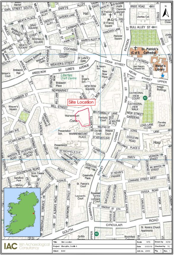
Map with site location highlighted