County: Waterford Site name: BALLYMACLODE
Sites and Monuments Record No.: N/A Licence number: 06E0990
Author: Dave Pollock
Site type: Burnt mound
Period/Dating: Undetermined
ITM: E 665137m, N 609817m
Latitude, Longitude (decimal degrees): 52.236240, -7.046340
The simultaneous discovery of a gold bracelet and burnt mound during monitoring of the new Waterford main drain launched a six-week excavation. One further piece of prehistoric gold jewellery was recovered.
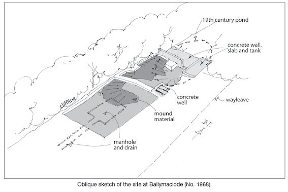
The mound is perched on a low cliff above the tidal Suir, at a natural spring. The spring appears to have been replaced by a deep pit, but this was infilled to accommodate a large rectangular trough and a second deep pit.
Both gold items were recovered from late levels.

Knockrower Road, Stradbally, Co. Waterford