2006:1807 - BALLYDAVID (Site AR26), Tipperary
County: Tipperary
Site name: BALLYDAVID (Site AR26)
Sites and Monuments Record No.: N/A
Licence number: E002370
Author: Colum Hardy, for Valerie J. Keeley Ltd.
Author/Organisation Address: Brehon House, Kilkenny Road, Castlecomer, Co. Kilkenny
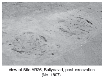
Site type: Enclosure, House - 19th century and Field boundary
Period/Dating: Multi-period
ITM: E 616956m, N 655408m
Latitude, Longitude (decimal degrees): 52.649612, -7.749409
An excavation was commenced in October 2006 and continued into early 2007, in advance of the proposed M8/N8 Cullahill to Cashel road improvement scheme. Prior assessment and centreline testing was carried out in 2005 (Excavations 2005, No. 1388, A027/011). The site was located c. 2km north-west of Littleton on either side of the Littleton to Thurles road. Excavation revealed a large enclosing ditch with an average depth of 1.3m and a width of c. 2.5m and an approximate internal diameter of 125m. The enclosure was situated on high ground with a considerable slope down to the east and crossed under the present road (Littleton to Thurles). There appeared to be an entrance to the south-east of the enclosure.
The enclosing ditch contained several layers, with frequent amounts of large stone at the base, possibly slip from some associated bank. The remains of a substantial pot/vessel have been recorded close to the base of the ditch on the southern side of the road. The base appears intact, with a series of various body sherds lying in close proximity. The pottery appears prehistoric, possibly Bronze Age, although specialist attention will be required to verify type and date. A large amount of animal bone and antler was retrieved from the ditch, with one piece of antler having evidence for cut marks, possibly showing the beginnings of a handle. A bone spindle whorl, rounded with a central perforation, and a saddle quern were also recovered.
A number of small features were originally located within the interior of the enclosure (post-holes, stake-holes, pits, etc). Three small areas of burning (probable furnaces) were revealed exterior to the enclosure, including a small furnace excavated on the southern side of the road, which produced vast amounts of charcoal and vitrified clay.
A 19th-century house on the extreme eastern side of the site was also excavated. Beneath the fireplace of the house was a concentration of charcoal that produced iron slag, possibly indicating use as a forge.
Additional geophysical surveys were carried out indicating the continuation of the enclosing ditch north-westwards beyond the CPO. A number of linear features, possibly field drains and boundary ditches, were also identified on the geophysical mapping.