2006:1348 - DROGHEDA: River Boyne, Louth
County: Louth
Site name: DROGHEDA: River Boyne
Sites and Monuments Record No.: N/A
Licence number: 06E0837
Author: Kieran Campbell, for Donal Boland
Author/Organisation Address: 6 St Ultan’s, Laytown, Co. Meath and Banagher, Co. Offaly
Site type: Pier/jetty and Wreck - Clinker
Period/Dating: Multi-period
ITM: E 710297m, N 775565m
Latitude, Longitude (decimal degrees): 53.718091, -6.328913
From 23 October to 9 December 2006 Drogheda Port Company (DPC) undertook capital dredging on a 1.2km stretch of the River Boyne downstream from the town centre, between Tom Roe’s Point and Doner’s Green. Pre-development surveys and monitoring of dredging were carried out in accordance with the requirements of the Underwater Archaeology Unit, DEHLG. This licence was first issued to investigate a double row of oak posts noted during an intertidal and marine geophysical survey undertaken by Donal Boland in advance of the dredging scheme. The post structure was situated on the lower foreshore immediately downstream of the Flogas terminal on the south bank of the River Boyne (Lagavooren townland, 310624 275599). The 141 oak posts, 100–110mm in diameter, were arranged in two parallel rows set 1.7–1.8m apart (c. 6ft) and ran west–east for 76m, gradually inclining to a terminus at the low-water mark. The posts ranged in height from 0.03m to 0.95m, the highest among the group of posts at the low-water mark. A mat of brushwood, 1m by 2.5m in extent and 0.3m thick, at the terminus of the post rows was identified as furze (Ulex europaes). Excavations carried out during suitably low tides in August, September and October 2006 concluded that the structure was the remains of a jetty or an access walkway to a channel marker shown at this location on a plan in DPC archives of the river and harbour in 1863.
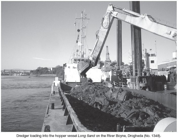
Monitoring was continuous during the eight-week dredging programme, which operated on a 24-hour basis. Monitoring was conducted primarily by K. Campbell and B. Hayden, with additional monitoring by D. Boland and C. Herron. The dredging contractor, Irish Dredging Co. Ltd, employed the backhoe dredger Manu-Pekka, which used a 6m2 bucket to load into two split hopper barges, the Cork Sand and the Long Sand. Usually five loads of up to 1000m2 were removed to the dumping ground offshore each day. Monitoring from the bridge or deck of the barge provided the clearest view of the material being loaded. When objects of interest were observed during dredging, the loaded bucket was held at the side of the hopper so that the object could be inspected. The most commonly occurring items were glass and plastic bottles, aluminium drinks cans, tyres and other modern detritus, and also many natural timbers, from twigs to large tree trunks up to 0.5m in diameter and up to 4m long.
Archaeological finds consisted of fragments of three logboats, several worked timbers including part of a ship’s rib, a barrel stave and a complete adult female skull. Of most interest was the discovery of the in situ wreck of a clinker-built vessel, probably a small ship of 12–20m size and possibly of medieval date. The wreck was impacted on by the dredger at 22.30 hours on 3 November when monitor B. Hayden noted timbers in the black silt in the excavator’s bucket (311070 275776). Dredging was halted and the area delimited for further investigation. A series of non-invasive marine geophysical surveys conducted in late November to early December by the Centre for Maritime Archaeology, University of Ulster, confirmed the presence of an intact articulated section of wreckage (see No. 1331, Excavations 2006). It is proposed that the wreck will be excavated in 2007 in a joint exercise by the Underwater Archaeology Unit, DEHLG, the National Museum of Ireland and Drogheda Port Company.