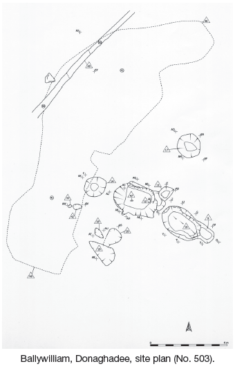
2006:503 - DONAGHADEE: Ballywilliam, Down
County: Down
Site name: DONAGHADEE: Ballywilliam
Sites and Monuments Record No.: N/A
Licence number: AE/06/65
Author: Robert M. Chapple, for Northern Archaeological Consultancy Ltd.
Author/Organisation Address: 19 Irwin Drive, Belfast, BT4 3AR
Site type: Burnt mound
Period/Dating: Undetermined
ITM: E 757277m, N 880428m
Latitude, Longitude (decimal degrees): 54.649629, -5.561668
From 27 March to 12 April 2006 monitored topsoil-stripping was carried out in advance of the construction of the Donaghadee wastewater treatment works. The development site lay on the High Donaghadee Road, to the west of Donaghadee town, beside the former Donaghadee Carpet Factory, in gently rolling pasture, at a height of c. 17m OD.
During monitoring, a small area was identified as being of archaeological potential. This area measured 13.59m (north to south) by 12.69m, enclosing an area of 135.63m2. The site lay just to the south-east of the former course of a small stream, identified from aerial photography. Excavation revealed the presence of four troughs, seven pits, one stake-hole and one spread of burnt-mound material.
The main features were the C10 and C12 troughs. C10 (2.4m by 1.5m by 0.6m) contained four fills, all of which contained large quantities of heat-fractured sandstone and basalt. The base of the C12 trough (2.6m by 1.6m by 0.45m) contained the impressions and charred remains of a plank and lath base. Although very fragmentary, it appears that thicker ‘planks’ were laid north-west to south-east, while thinner ‘laths’ were laid from north-east to south-west. No indication of any vertical remains could be identified, suggesting that this wooden base was utilised without any upstanding walls. It appears that the sides were, at least partially, sealed by a layer of sticky clay. Above this, the trough contained four further layers of heat-fractured sandstone and basalt. Each trough had an associated pit at its eastern end (C9 and C11). Whether these functioned as subsidiary troughs or as ovens, or were simply intended to facilitate ease of access to the main features, is unclear. Two further subsidiary troughs (C14 and C17) lay outside these and were, again, filled with heat-fractured sandstone and basalt. One of these troughs (C14) was partially covered by the F41 horseshoe-shaped spread. This spread lay slightly downslope from the remainder of the features, at the edge of a palaeo-channel, and was composed of the same mix of charcoal-rich material and heat-affected stones that characterised the trough fills.
Although these features produced no artefacts, a small number of pieces of struck flint and one hammerstone were recovered from the surrounding area during the monitored topsoil removal.