County: Cork Site name: CARRIGTWOHILL: Barryscourt
Sites and Monuments Record No.: CO075-018001 Licence number: 98E0238
Author: Dave Pollock
Site type: Castle - tower house
Period/Dating: Late Medieval (AD 1100-AD 1599)
ITM: E 582177m, N 572522m
Latitude, Longitude (decimal degrees): 51.904560, -8.259005
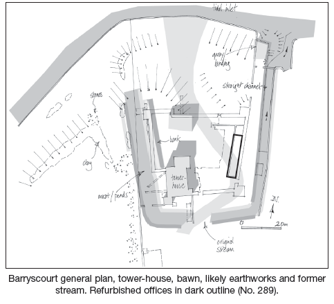
In 2006 further works, funded by the OPW, to enhance Barryscourt Castle as a visitor attraction involved refurbishing a post-medieval range of farm offices inside the bawn and replacing the guides’ hut outside, under archaeological supervision.
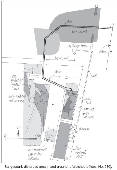
Most of the material removed from the footprint of the farm offices was associated with their construction in the 18th/19th century. A fragmentary surface of burnt-mound material, partly exposed below, is probably associated with the late medieval bawn. Generally the late medieval ground level appeared to be puddled rubble with midden and ex situ clay building debris, with no evidence for early buildings against the east bawn wall.
In the north-east corner of the bawn the cut for a drain exposed truncated clay subsoil less than 0.4m down.
North of the bawn this drain cut an infilled pond and an earlier burnt mound.
Foundation trenches for a new guides’ hut 40m south of the bawn cut through 20th-century material on to clay subsoil.


Knockrower Road, Stradbally, Co. Waterford