County: Wexford Site name: MONEYLAWN LOWER
Sites and Monuments Record No.: N/A Licence number: A003/014
Author: Liam Mckinstry, for Valerie J. Keeley Ltd.
Site type: Designed landscape - tree-ring, Structure, Pit and Enclosure
Period/Dating: Multi-period
ITM: E 713612m, N 656625m
Latitude, Longitude (decimal degrees): 52.648913, -6.320984
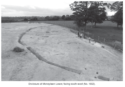
Site 13 at Moneylawn Lower was identified due to the location of a tree ring which lay to the immediate west of the CPO area of the N11 Gorey–Arklow link road scheme. Excavation showed that the tree ring formed the inner bank and ditch of a large double-ditched enclosure. The inner ditch is estimated to enclose an area c. 25–30m in diameter; the maximum width was 2.8m and the maximum depth was 1.4m. The outer ditch was estimated to enclose an area c. 75–80m in diameter, which has since been confirmed by a geophysical survey conducted over the unexcavated part of the enclosure; the width was c. 1m and the depth was c. 0.85m. The entrance into the enclosure faced north-east and consisted of causeways over the outer and inner ditches. Traces of revetment and a metalled surface were identified at the entranceway at the inner ditch and a possible gateway was shown by a number of post-holes at the outer enclosure. Finds recovered from the ditches suggest an early medieval date for the enclosure. These finds included a perforated whetstone and a corroded metal and antler object, which may have been a handle of a tool.
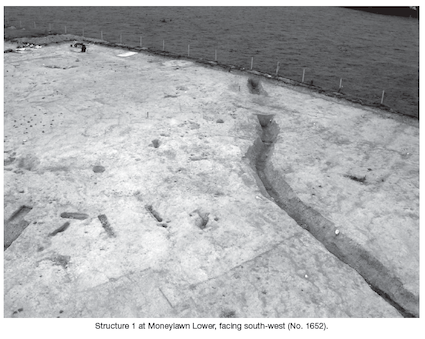
Two possible structures were located to the south-east of the outer enclosure. Structure 1 was located closest to the outer ditch and consisted of a concentration of post-holes, stake-holes, pits and hearths. These features were concentrated in an area c. 10m by 9m. A curving arc of post-holes and stake-holes in the north and north-east became less frequent in the southern part of the structure. There was a possible entranceway in the north-eastern part of the structure where two parallel lines of post-holes were seen to project out from the structure. A burnt subcircular hearth pit was located within the structure and seemed to have been placed so that it lined up with the entranceway. The cut of this pit formed a bowl shape and contained moderate amounts of charcoal and burnt bone. Another oval-shaped pit was located within the structure to the south-east of the entranceway. This pit also showed evidence of in situ burning and contained large quantities of charcoal and burnt stone; the pit also contained a corroded iron nail.
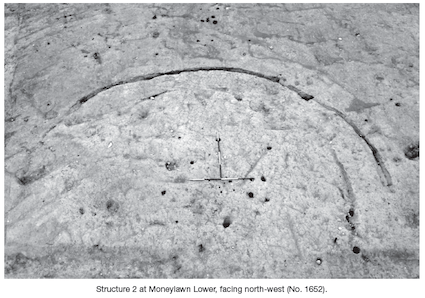
Structure 2 was located to the south-east of Structure 1. It consisted of two concentric curvilinear gullies and its diameter was c. 15m. Within the structure there were a number of post-holes, stake-holes and hearths. To the immediate south-east of the structure ran a modern field boundary, which crossed the site in a north-east/south-west direction. To the north-east and east of the structure were a number of deposits and pits which may have been associated with the structure. The stake-holes and post-holes within the structure did not appear to be structural but seemed to be associated with the hearths.
Several circular and subcircular pits were identified, which contained a number of prehistoric artefacts. One group of bowl-shaped pits were tightly clustered together some 6m south of the outer enclosure ditch. This group consisted of five pits of varying sizes, which contained a large amount of prehistoric pottery, stone tools, burnt hazelnuts and a black flint scraper. Other pits identified further to the south were not as tightly clustered. These pits also contained considerable amounts of prehistoric pottery, worked flint, stone tools and burnt hazelnuts. The contents of the pits seemed to be deposited as ritualistic offerings rather than as refuse. Two of the pits had also suffered from intense heat and it may be possible that they were kilns, furnaces or ovens that were associated with the enclosure. A number of other isolated features were located to the south of the enclosure and structures. These features were mainly evidence of agricultural activity and field clearance.


9 Ballantyne Place, Steamboat Quay, Limerick