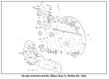
2004:1853 - BRAY: Giltspur, Wicklow
County: Wicklow
Site name: BRAY: Giltspur
Sites and Monuments Record No.: WI008-005
Licence number: 04E1324
Author: Abi Cryerhall, Margaret Gowen & Co. Ltd.
Author/Organisation Address: 27 Merrion Square, Dublin 2
Site type: Structure and Kiln
Period/Dating: Undetermined
ITM: E 725275m, N 716108m
Latitude, Longitude (decimal degrees): 53.180678, -6.125773
The monitoring (04E1201, No. 1852, Excavations 2004) of a large-scale retail development off Giltspur Lane, Bray, Co. Wicklow, uncovered the remains of a subrectangular structure and a grain-drying kiln close by.
The development encroached on the zone of archaeological potential associated with a tree ring around a centrally located large granite boulder. The date of this monument is not certain; it may be associated with the large demesnes in the area, as it does not appear on the first-edition OS map.
The site was a partially wooded field prior to development and the land sloped down to the northeast and north-west. The RMP is located further up the slope and was not part of this development. The archaeological features were uncovered in the field adjacent to the monument.
Structure and kiln
The structure was partially cut into the sloping land to create a level floor. It was subrectangular in plan and measured 5.2m in length and 3.8m in width. It consisted of a curving cut (maximum of 0.4m in depth) into the hill slope around the north-eastern half. This formed the back of the structure. There were six main post-holes around the perimeter for support and weight-bearing posts. There may have been more structural posts, as collapsed in from the cut edge were a number of large stones. These may have been used to prop posts against the cut edge. No internal post-holes were used.
There were two entrances. One of these was on the western side and the other was through a porch structure constructed with posts and smaller stakes. Located along the entrance porch was a drainage gully, the fill of which contained a lump of corroded iron.
The internal space was divided in two by a slot-trench with two small post-holes at either end. The surface was comprised of small stones in a compacted clay floor. There was evidence of one small hearth and two waste pits. The fill of one of these pits contained large quantities of charred barley, identified by Penny Johnston.
Located to the south-west of the structure was the grain-drying kiln. This consisted of a cut fire chamber, with evidence of in situ burning on the base and sides of the cut. Connected to this was a cut for the flue, 2.2m in length. In the fire chamber of the kiln were set upright stones, stone sockets and postholes, all indicating the presence of a superstructure, possibly a platform to hold the grains.
The fill of the fire chamber was analysed by Penny Johnston, who identified charred oats and wheat. Also within the backfill was a fragment of a granite rotary quern. The presence of this and the oats would suggest an early medieval date for the kiln. Radiocarbon dating results are pending at the time of writing.
The date for the structure was harder to establish. The only find came from the fill of the gully through the entrance porch. This lump of corroded iron could date from the late prehistoric to modern times. Radiocarbon results from this structure are pending; a number of factors can indicate a rough date for the structure. Though it may seem unusual to have a kiln and a structure so closely located, it may be the case that these two features are contemporaneous. The absence of occupation evidence such as food production (hearths, ash, etc.) or food waste (bones, marine shells) in the structure may indicate its function as a barn, perhaps for the storage of dried grains processed in the drying kiln. The shape of the structure would also indicate a later prehistoric or early medieval date.
There was evidence of a final burning event in the structure, with an extensive layer of charcoal-rich material sealing the pits and floor surface. The first layer of backfill over this also contained frequent charcoal lumps. So perhaps if these two features were contemporary, as is thought, it may not have been the wisest idea to locate a fire-hazardous drying kiln less than 1m from the storage barn.
Other features
Located 10m further uphill from the structure was a curvilinear cut with a tapered and rounded end, 12m in length. This feature was north-south in orientation and it curved slightly, respecting the curve of the cut part of the structure. This feature may have acted as a drain for the structure, directing water run-off from the hill away from the structure. A slightly curving ditch, orientated roughly east-west down the hill slope, acted also as a drainage feature. No finds were located within the ditch, which contained silt-rich fills. There was no way to determine if this ditch was contemporary with the structure, kiln or other drain, as there were numerous land drains noted during the topsoil removal across the development site, mostly post-medieval or modern.