2004:0851 - MONEYCOOLY, Maynooth, Kildare
County: Kildare
Site name: MONEYCOOLY, Maynooth
Sites and Monuments Record No.: KD010-040 and KD011-061
Licence number: 04E0644
Author: Carmel Duffy
Author/Organisation Address: Umberstown Great, Summerhill, Co. Meath
Site type: Burial ground and Furnace
Period/Dating: Early Medieval (AD 400-AD 1099)
ITM: E 694439m, N 736275m
Latitude, Longitude (decimal degrees): 53.368221, -6.580947
In May 2004 an assessment was carried out on a site for 241 houses between the Celbridge road and the M4 motorway at the south-east fringe of Maynooth. One small pit was recorded during test-trenching, which was followed, in June, by monitoring of topsoil-stripping over the entire site. Eight areas of archaeological potential were excavated between 5 July and 17 August.
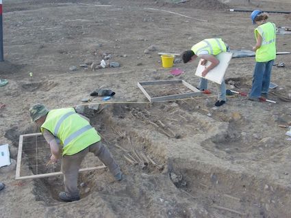
Initially, in Area 1, five inhumations were uncovered in a 5m by 6.5m area at the centre of the estate during topsoil-stripping for a through road. The cemetery, when fully exposed, had dimensions of 14m east-west by 6.5m. It was situated on a barely discernible low rise, defined by the 64m contour, in an area of level to slightly undulating topography. The burials were set out in six rows within a roughly subrectangular area, with two juvenile burials immediately to the north of the main group. The graves were simple unlined pits excavated through an upper, largely stone-free, subsoil into the surface of a lower stony clay subsoil that formed the base of the cuts. All but two were aligned east-west. There were occasional instances of small slabs laid at the side of the grave or overlying the interments. At least 55 individuals are represented among the burials, including disarticulated remains and skeletons disturbed by later grave-cuts. No artefacts were found with any of the burials, but the cemetery is most likely to date to the Early Christian period.
Ten additional features were investigated within a 40m radius of the cemetery. To the west were two gullies, of which the first, 0.75m wide and 0.54m deep, ran east-west in a slight arc for 15.6m and extended beyond the limit of excavation; the second was aligned north-south and measured 3.5m long, 0.6m wide and 0.26m. The larger gully produced a whetstone, slag and animal bones. Eight pits/deposits ranged in size from 0.6m to 3.1m across and up to 0.6m deep. At least one of the pits, containing a tanged iron billhook or sickle and a piece of glass, appears to be post-medieval in date. No evidence was found for an enclosing ditch either within the area of the excavation or during monitoring of topsoil-stripping and the excavation of service trenches and foundations in the surrounding area.
In Area 2 four undated features were uncovered in a 20m by 10m area c. 200m east of the cemetery. The fills of two subcircular pits, each c. 0.8m in diameter, and an elongated cut, 3.5m by 0.55m and 0.32m deep, contained charcoal and very occasional small fragments of burnt bone. These inclusions were also present in a deposit, 0.16m thick and at least 5m in extent, which overlay subsoil in the east of the cutting.
In Area 3 two adjacent bowl furnaces, with diameters of 0.66m and 0.9m and depths of 0.37m and 0.45m respectively, which contained metal slag and charcoal were found. Nearby was a hearth, comprising a charcoal-rich deposit, 0.7m by 0.52m and 0.05m thick, over oxidised subsoil.
In Area 4 three subcircular to oval pits, two of which were intercut, contained charcoal-flecked fills with occasional burnt stone. Pit sizes ranged from 0.6m to 0.86m with depths of 0.1–0.15m.
In Area 5 two deposits of dark-brown soil with charcoal proved, on excavation, to be the result of tree-root disturbance.
In Area 6 a charcoal-flecked deposit filling an irregular cut, 0.37m across and 0.1m deep, may be the truncated remains of a post-hole. Also in this area was a large funnel-shaped pit, 2.8m in diameter and 1.2m deep with four fills containing charcoal inclusions.
In Area 7 four small undated charcoal-flecked deposits, approximately in line, may represent the fills of truncated stake-holes. The largest measured 0.23m across, filling a 0.18m-deep cut with a pointed base.
In Area 8 two irregular cuts had fills with charcoal inclusions but no other finds. The larger feature measured 1.85m by 0.88m and was up to 0.34m deep; the second measured up to 0.8m across and was 0.35m deep.