2003:2062 - ARKLOW BANK WIND PARK, Wicklow
County: Wicklow
Site name: ARKLOW BANK WIND PARK
Sites and Monuments Record No.: N/A
Licence number: 03E1101
Author: Kieran Campbell
Author/Organisation Address: 6 St Ultan's, Laytown
Site type: Excavation - miscellaneous
Period/Dating: Multi-period
ITM: E 739462m, N 673692m
Latitude, Longitude (decimal degrees): 52.796190, -5.931960
Phase 1 of the Arklow Bank Wind Park development in 2003 proposed to install seven wind turbines on the Arklow Bank, c. 10km off the coast of County Wicklow. The turbines were to be installed in a single row running north-south along the bank. Monitoring was undertaken between 27 July and 24 August 2003. The monitoring archaeologists on board were Labhaoise McKenna and Benen Hayden.
No monitoring of dredging operations had previously been undertaken on the Arklow Bank, where the National Maritime Wreck Register lists c. 300 vessels as having been wrecked. The register lists only those vessels lost from the time that records began but demonstrates that the area was the site of wreckings from the earliest times. Pre-development geophysical site surveys by Boland Archaeological Services Ltd identified sixteen sites of archaeological potential (licence No. 02R093) within the present proposed development area.
Boland Archaeological Services Ltd was commissioned by G.E. Wind Energy to monitor the dredging of a channel measuring 200m by 50m by 6.5m adjacent to the location of turbine No. 5. This channel was to allow the pontoon pile driver, Jumping Jack, with a draft of 6.5m, to be manoeuvred to and from the location of the turbine.
The initial phase of monitoring was conducted between 27 July and 3 August 2003, employing the backhoe dredger Atlas. A hopper barge, Den Droge, was tied alongside to collect and dump dredged material. A small coin and a sherd of white pottery were observed in the hopper’s hold. The Atlas was replaced by the suction hopper dredger Zeezand Express during the second phase of monitoring, conducted on a 24-hour basis between 13 and 24 August 2003.
Sand and gravel were sucked from the seabed and deposited in the hopper of the dredger. A grid was attached to the dredger head to prevent large items being sucked up through the pipe. As the material being dredged entered the suction pipe underwater, monitoring was limited to the inspection of the dredge head when it was lifted at the end of each load. This was the only opportunity to inspect the dredge head. However, had the pipe become blocked by impacting upon large objects, such as timbers, suction would have become impaired and the dredge head raised for inspection. No such instances occurred during this work.
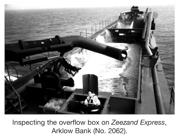
An overflow box with a metal grate was located in the aft compartment of the barge’s hold. The grate collected debris which had been sucked up into the hold and discharged with the sand and water through the fine grid. Although only a limited volume of the hopper’s load exited the vessel via the overflow box, a number of artefacts were recovered. Sand deposits built up on deck during each load and provided another opportunity to retrieve random finds. Artefacts recovered included two worked flint nodules, fifteen sherds of glazed white earthenware dating from the mid-19th to the mid-20th century, a clay-pipe stem and two metal conglomerates. It is unlikely that the percentage and type of finds found is representative of the overall debris on the Arklow Bank, as the majority of the spoil from the hopper did not exit the barge via the overflow box.

