2003:1851 - ADAMSTOWN/KNOCKANAGH (Site 3), Waterford
County: Waterford
Site name: ADAMSTOWN/KNOCKANAGH (Site 3)
Sites and Monuments Record No.: N/A
Licence number: 02E0275
Author: Ian Russell, Archaeological Consultancy Services Ltd.
Author/Organisation Address: Unit 21, Boyne Business Park, Greenhills, Drogheda, Co. Louth
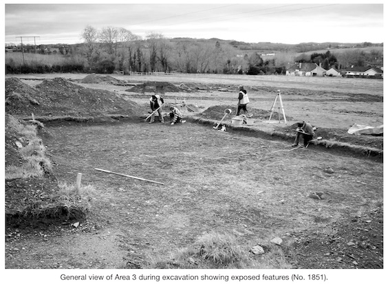
Site type: Kiln, Pit and Structure
Period/Dating: Undetermined
ITM: E 652495m, N 609812m
Latitude, Longitude (decimal degrees): 52.237541, -7.231404
Testing was carried out between 19 March and 11 April 2003 on behalf of Waterford City Council in advance of the construction of the new N25 Waterford Bypass. Three potential prehistoric industrial and domestic sites were exposed during the testing, where ten fields were assessed by means of machine-excavated trenches. Adamstown 1 is located c. 80m east of Adamstown 2, while Adamstown 3 is located 280m east of Adamstown 2. The Bord Gáis pipeline was originally located within Fields 1–4 but was subsequently relocated outside the CPO to the south. This was monitored by Jonathan Dempsey (No. 1857, Excavations 2003, 03E1064). The potential enclosure at Knockanagh 1, 500m west of Adamstown 3, was tested by Linda Clarke (No. 1899, Excavations 2003, 03E0412).
The first site, Adamstown 1, was exposed in Field 1 in Trench 3. It contained one kiln, one pit, one possible pit, three stake-holes, two possible stake-holes, four post-holes, three possible post-holes, two spreads and one area of burnt clay. The kiln contained a large lump of slag and other small fragments of slag and appeared to lie within the centre of a possible oval-shaped structure. A second area was also exposed a short distance to the west of the kiln, where five pits and one spread were exposed. A single oval-shaped spread was exposed in Trench 1 and an oval-shaped spread was also exposed in Trench 2.
The second site, Adamstown 2, was exposed in Field 2 in Trench 31. It consisted of a figure-of-eight-shaped kiln. It measured 1.9m in length, 1.4m in width and had been filled with a mid- to dark-brown clay.
The third site, Adamstown 3, was exposed in Field 3. The first area was exposed in Trench 34 and contained eight possible post-holes, which may represent the remains of a possible subrectangular structure. The second area was also exposed in Trench 34 and contained the remains of an oval-shaped structure. One pit, two pits/post-holes, three stake-holes, two possible pits, two possible hearths and twenty post-holes were exposed. No further archaeological features or deposits were exposed.
All three sites are currently undergoing archaeological resolution.