2003:2367 - CASTLENAGEEHA, CO. MAYO, Mayo
County: Mayo
Site name: CASTLENAGEEHA, CO. MAYO
Sites and Monuments Record No.: N/A
Licence number: E1121
Author: MARY CAHILL AND MAEVE SIKORA
Author/Organisation Address: —
Site type: Graves of indeterminate date
Period/Dating: —
ITM: E 520959m, N 835105m
Latitude, Longitude (decimal degrees): 54.258667, -9.213112
Introduction
In April 2003 human bone was discovered eroding out of a cliff face at Castlenageeha near Killala, Co. Mayo. It was noticed by walkers on a cliff path and reported to the Gardaí at Ballina. The site was investigated by the Gardaí, who undertook an excavation of the site and subsequently informed the NMI.57 According to Garda Kennedy, the body was covered with a layer of fist-sized stones. A visit was subsequently made to the site by Mary Cahill and Maeve Sikora, and a second burial was located a few metres from the first.
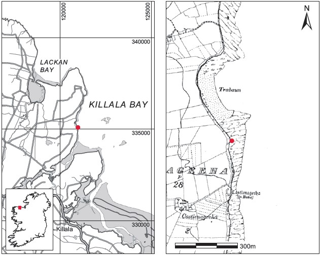
Location (Fig. 6.33)
The site was in the townland of Castlenageeha in east County Mayo, close to the border with County Sligo.58 The burials were eroding out of a cliff face on the southern end of Trabaun beach on Kilcummin Head, at the west side of Killala Bay. The headland is rich in archaeological remains; some 200m south of the site is Castlenageeha castle, while Kilcummin church and holy well lie approximately 2km to the north. A number of long cists were also east side of the headland at Carrowsteelagh, and human remains are frequently found on a mound in Beltra townland, a site known as Greenhills in Lackan Bay. A small group of rocky islands approximately 1.5km east of the site, in Killala Bay, are marked on the Ordnance Survey map as ‘Bone Rock
Description of site
The majority of the human remains were located 0.36–0.54m below ground level in a very low cliff that was being actively eroded. Bones were visible in an area measuring 1.06m across. The site had been completely disturbed by the time of excavation but it was clear that the covering of fist-sized stones described by Garda Kennedy comprised a layer of naturally occurring

Fig. 6.33—Locationmap, Castlenageeha,Co. Mayo.
water-rolled stones, which was visible in section all along the beach. No other stones or slabs were found in the vicinity of the burial, suggesting that this was an unprotected interment. The burial was completely disturbed but appears to have consisted of the unburnt remains of one individual (2003:19). Bones had been removed by the Gardaí, but some bones of the upper body were uncovered during excavation of the area. It was not possible to establish the disposition of the body as skull fragments were found throughout the deposit. According to the Gardaí, a corroded iron object was found among the bones but was not retained. Approximately 4m south-east of the main concentration of remains, some foot bones were discovered on a sandy ledge at a depth of 0.84m below grass level. There was no evidence of grave structure here either. The remains consisted of the bones of one foot and part of a pelvic bone. The bone was severely eroded and white in colour, and appeared to have been other remains were found in the vicinity and no associated artefacts were recovered.
Comment
In the absence of finds or other dating evidence these burials must be regarded as undated. It is not possible to say whether there is any association between the two burials.
57. The NMI was later informed that there was local pressure to remove the burial, as people suspected that the remains were those of a person missing from the area.
58. Parish of Kilcummin, barony of Tirawley. OS 6in. sheet 15. IGR 120991 335100.
