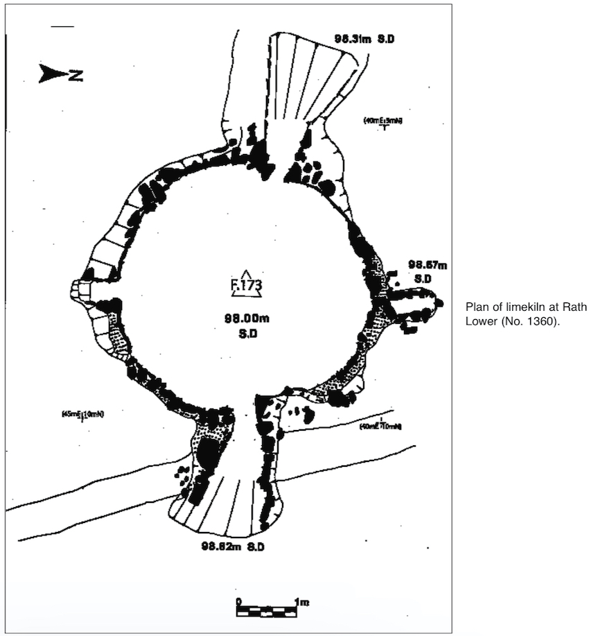
2002:1359 - RATH LOWER, Louth
County: Louth
Site name: RATH LOWER
Sites and Monuments Record No.: N/A
Licence number: 00E0650 ext.
Author: Richard Clutterbuck, Cultural Resource Development Services Ltd.
Author/Organisation Address: Unit 4, Dundrum Business Park, Dundrum, Dublin 14
Site type: Building and Kiln - Lime
Period/Dating: Medieval (AD 400-AD 1600)
ITM: E 699579m, N 792839m
Latitude, Longitude (decimal degrees): 53.875422, -6.485646
Finola O’Carroll carried out test excavations at Rath Lower, Grange, in 2000 before a proposed sheltered housing development (Excavations 2000, No. 707). Testing revealed archaeological features, including walls, at the southern end of the site; it was recommended that the development plans be altered to avoid the archaeology and that further testing or monitoring be carried out if the development was to proceed.
Monitoring of the removal of topsoil was carried out from 15 to 22 April 2002; further monitoring was carried out in May and June, resulting in the removal of all of the topsoil, modern boundary ditches and overburden. Monitoring revealed medieval and early modern features, including the walls of a structure and a medieval limekiln. The features were resolved through preservation by record (see No. 1360, Excavations 2002, 02E0530) and, in the case of the walls and the limekiln structure, preservation in situ. The development works were suspended pending a reapplication for planning permission; monitoring at this site will continue in early 2003, when the construction restarts. The remaining archaeological works consist of the monitoring of the excavation of a waste treatment unit and a sump.