County: Limerick Site name: TULLERBOY (BGE 3/72/3)
Sites and Monuments Record No.: N/A Licence number: 02E0472
Author: Emer Dennehy, for Margaret Gowen & Co. Ltd.
Site type: Ring-ditch and Metalworking site
Period/Dating: Multi-period
ITM: E 554863m, N 636555m
Latitude, Longitude (decimal degrees): 52.478558, -8.664453
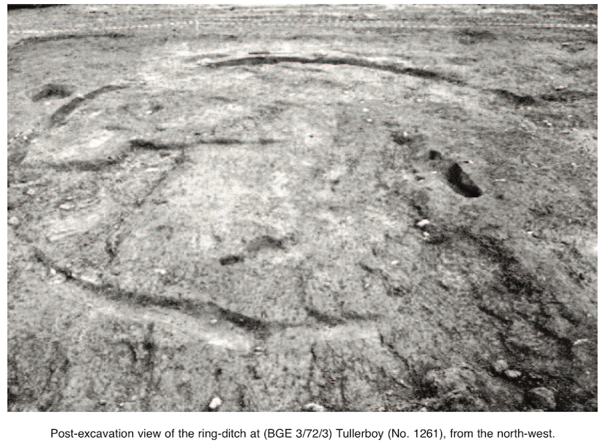
The site was exposed during monitoring of topsoil-stripping along Section 3 of the Bord Gáis Éireann Pipeline to the West, from Goatisland, Co. Limerick, to Gort, Co. Galway. This site is on a gently sloping plain commanding extensive views of the surrounding terrain. The area of investigation measured 12.6m north–south by 20m, with archaeological material extending northward outside the limits of the Bord Gáis wayleave. The site had two main phases of activity: the first related to the construction and use of a ring-ditch, and the second related to ironworking activities.
Phase I
The ring-ditch had an internal diameter of 8m (external diameter 9m) and an average depth of 0.3m. It was oriented north–south and composed of a northern and a southern arc, with causeways present in both the north-west and the south-east quadrants. These were 6.25m and 1.55m wide. A blue bead was found in the northern arc. Both arcs were filled with grey/brown sandy clays. No stakes were identified in the ditches.
No structures were identified on the site, although a number of isolated stakes and large pits were found both within and immediately outside of the enclosed platform. Most of these pits contained sterile fills, providing no insight into their function.
A small complex of nine large stakes was situated 3.5m north-west of the ring-ditch. The stakes were circular in plan and averaged 0.22m wide and 0.19m deep. They were vertically inserted and were removed before decay. These stakes formed no coherent structure, but additional stakes may be present to the north, outside the limits of the wayleave.
A curvilinear ditch was excavated 0.1m south of the ring-ditch; it was just 1.31m long. A blue bead was retrieved from this feature.
Phase II
Industrial metal smelting/ironworking took place during this phase. Pits associated with this phase truncated the terminal of the ring-ditch and were positioned centrally within the north-western causeway. Large quantities of slag, in addition to charcoal and bone, were retrieved from these features.
It is assumed that the original function of the ring-ditch was domestic, with the fills of the various features indicating that gradual and natural infilling and decay of the features took place. The truncation of the ring-ditch by the metalworking activity indicates that the ring-ditch had been completely abandoned by the start of the Phase II activities.

2 Killiney View, Albert Road Lower, Glenageary, Co. Dublin