2002:0429 - MALIN MORE, Donegal
County: Donegal
Site name: MALIN MORE
Sites and Monuments Record No.: SMR 89:3, 89:2
Licence number: 02E1433
Author: Martin A. Timoney
Author/Organisation Address: Bóthar an Chorainn, Keash, Co. Sligo
Site type: Field system
Period/Dating: Prehistoric (12700 BC-AD 400)
ITM: E 551049m, N 882706m
Latitude, Longitude (decimal degrees): 54.690092, -8.759230
An eighteen-hole golf-course attached to Óstán Ghleann Cholm Cille is being developed. The townland is rich in megalithic tombs, one of which, a six-chamber complex, is in the valley bottom below the hotel. In 1974 Flanagan (1977) discovered pre-bog field walls to the east of the hotel. Two monuments are within the property, SMR 89:2, an enclosure site, and SMR 89:3, pre-bog field wall(s).
Three trenches were opened. Two, both 55m long and 2m wide, revealed c. 1m of bog over the natural, undisturbed ground, which had occasional stones in its surface make-up. There were no indications of archaeology in these trenches.
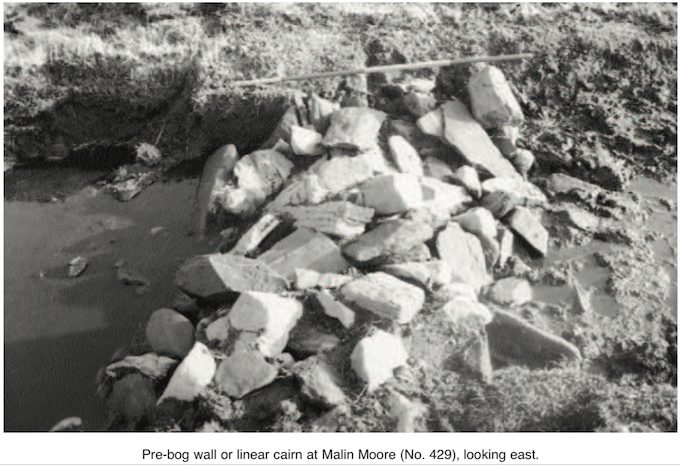
The third trench was 80m long and 1m wide at the bog surface, narrowing to c. 0.3m at the base of the bog. Above a break in the slope and about midway along the trench a pre-bog wall was encountered. There was 0.3m of bog over it, but turf cutting had taken place here. This wall was 1.8m wide at the base and 0.5m high. The white, grey and orange metamorphic stones varied in size. They were positioned in a somewhat linear and random fashion, as if dumped rather than built into a wall. Not enough was exposed to establish whether it was a collapsed wall or to decide how effective it would have been as a barrier.
The direction of the wall suggests that it will not be interfered with by any golf-course development works. It will be left exposed as an archaeological feature. Analysis of aerial photographs is continuing, to see whether this exposed wall can be identified and whether more walls are visible where the bog has been cut away.
The enclosure site is behind the hotel, and two tees and one green were proposed for two fields here. There is no trace of an enclosure above ground. This field has seen considerable activity over the last two centuries, as it served as the vegetable garden for the coastguard station from the mid-19th century and for the hotel since 1932.
Test-trenches were opened away from the supposed enclosure site to release ground for greens and tees around this field. A 35m east-north-east/west-south-west trench was opened in the field between the hotel and the golf-course. This trench could not be continued westward as several services passed through it. A further section was opened in the south-west part of this field, where there was a bank of clay. The presence of a buried car engine dated this bank.
An east–west trench was opened across the proposed new area for the eighteenth green. This trench was 40m long and north of the supposed enclosure. Nothing of significance was noted.
No archaeology was revealed during monitoring of the preparation works for the golf-course on the hillside behind the hotel in December 2002 and up to the end of January 2003. Development works will take place over two years and will be monitored.
Reference
Flanagan, L.N.W. 1977 Peat, forest and field systems in SW Donegal. Irish Archaeological Research Forum 4 (1), 31–5.