2002:0153 - CRAGBRIEN (BGE 3/23/2), Clare
County: Clare
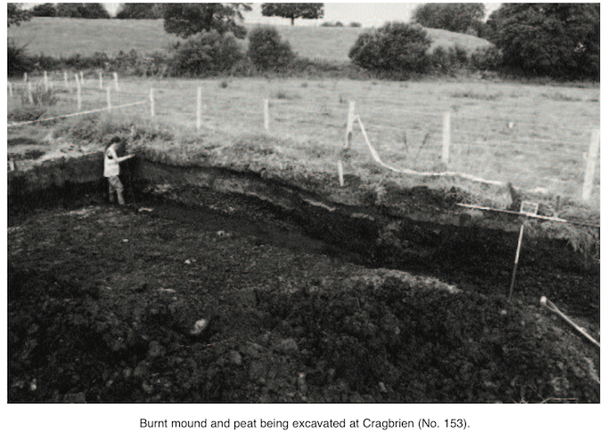
Site name: CRAGBRIEN (BGE 3/23/2)
Sites and Monuments Record No.: N/A
Licence number: 02E1352
Author: Graham Hull, Margaret Gowen & Co. Ltd.
Author/Organisation Address: 2 Killiney View, Albert Road Lower, Glenageary, Co. Dublin
Site type: Burnt mound
Period/Dating: Prehistoric (12700 BC-AD 400)
ITM: E 530774m, N 669233m
Latitude, Longitude (decimal degrees): 52.769695, -9.025855
This site was examined as part of Bord Gáis Éireann’s Pipeline to the West project. Part of a burnt mound, most which was buried under alluvial deposits, was excavated. Perhaps half of the mound lay outside the pipeline easement in a field to the north-west, and it is estimated that the mound, probably roughly circular, had a diameter of 12m and stood 0.7m high. Because of alluvial deposition, however, the mound was not visible as an earthwork. Very boggy ground and a small stream were c. 25m to the west of the site.
The mound was seen to overlie, in part, a peat-filled hollow to the south-west. This natural hollow lay at the foot of a steep hill farther to the south-west. Laminated deposits of burnt limestone constituted the body of the mound, which had been cut by a modern drain. A column sample was taken through the peat and mound and should allow reconstruction and possible dating of the environment immediately before the mound construction.
No evidence of a trough was recorded during the excavation, but, if such exists, it would lie in the adjacent field. The waterlogging encountered and the unworked wood seen in the underlying peat may suggest survival of a possible timber trough. A bulk soil sample of the earliest mound deposit was taken for charcoal recovery by wet sieving. A radiocarbon date and wood species identification should provide a construction date.