County: Louth Site name: TULLYALLEN 3
Sites and Monuments Record No.: N/A Licence number: 00E0947
Author: Kieran Campbell, for Valerie J. Keeley Ltd.
Site type: Enclosure
Period/Dating: Prehistoric (12700 BC-AD 400)
ITM: E 705548m, N 776697m
Latitude, Longitude (decimal degrees): 53.729239, -6.400446
The site was uncovered in May 2000 during topsoil-stripping for the R168 Link Road, a 700m length of single-lane carriageway linking the Drogheda– Collon road to the Mell Interchange on the Northern Motorway (Gormanston to Monasterboice). The excavation took place from 5 February to 23 March 2001. The site lay on the north-facing slope of a ridge c. 1km north of the River Boyne. There were extensive views from the site to the west, towards the Boyne Valley at Oldbridge and Dowth. On the southern flank of the same ridge, c. 200m to the south-east, two prehistoric barrows and an Early Christian cemetery, Tullyallen 1 and Mell 2, were excavated by R.M. Chapple and T.C. Breen (Excavations 2000, No. 715, 00E0429, and No. 695, 00E0430, respectively, and No. 869 above, Mell 2, 00E0430). On the opposing slope, 250m to the north across low-lying ground, a prehistoric site, Tullyallen 4, was excavated by C. Duffy (Excavations 2000, No. 717, 00E0832).
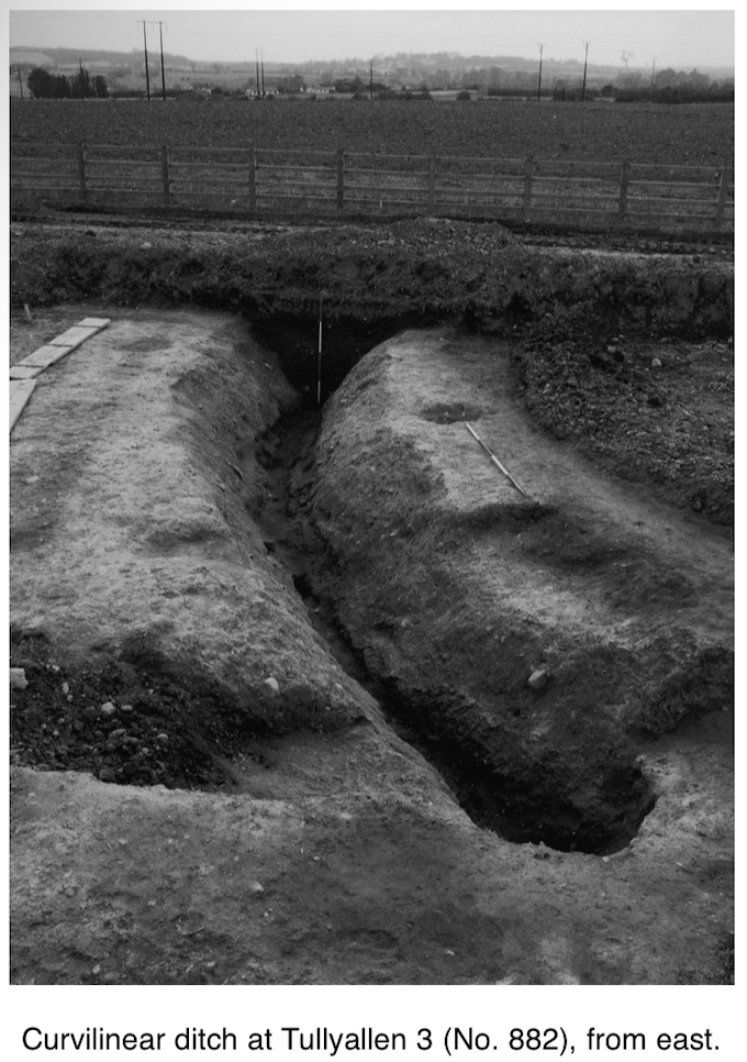
Dark deposits, containing burnt stone and flecked with burnt bone, exposed during topsoil-stripping, were found to be the uppermost fills of a curvilinear ditch. The ditch extended for 12.5m from the western edge of the road-take, curved to the north in a gentle arc, and had a terminus 1.5m from the eastern edge. The ditch profile was V-shaped, 1.98–2.9m wide at the top and up to 1.68m deep. The base was generally narrow, 0.2–0.6m wide, but widened to 0.9m over the easternmost 2.5m, ending in a bulbous terminal with bedrock exposed at the base. The bulk of the material filling the lower half of the ditch could be accounted for by erosion of the sides and from a possible bank. Natural subsoil exposed towards the base of the ditch consisted of pure sand and was subject to erosion by rainwater even during the short period of the archaeological excavation.
Finds were limited to a flint scraper, two waste flint flakes and a small thick sandstone disc, 70mm in diameter and 30mm thick, with an incised grid pattern on the two opposed flat surfaces. A small quantity of burnt bone was distributed sporadically throughout the ditch fills but was most frequent at the surface, where it occurred as a constituent of ‘burnt mound’-type deposits with burnt stones in charcoal-enriched soil.
If the excavated ditch was an arc of a circular enclosure, it would have had an external diameter of c. 32m. However, no return of the ditch was found during topsoil-stripping or in a test-strip made for a distance of c. 70m along the road-take to the north-west. The only other archaeological feature uncovered within the 28m by 14m excavation area was a linear cut, 0.16m wide and 0.25m deep, located 5m north of the large curvilinear ditch. The cut had a rounded terminal at the south end and was recorded for a length of 3.1m, extending north beyond the limit of excavation. Six flint flakes were recovered from the fill.

6 St Ultan’s, Laytown, Drogheda