2001:536 - GROIN (Site 1), Aghadoe, Kerry
County: Kerry
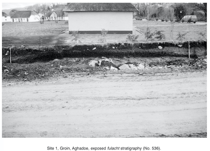
Site name: GROIN (Site 1), Aghadoe
Sites and Monuments Record No.: N/A
Licence number: 01E0066
Author: Emer Dennehy, Eachtra Archaeological Projects
Author/Organisation Address: 3 Canal Place, Tralee, Co. Kerry
Site type: Fulacht fia
Period/Dating: Undetermined
ITM: E 495318m, N 592574m
Latitude, Longitude (decimal degrees): 52.075199, -9.527122
Monitoring of ground disturbance work associated with the development of sixteen semi-detached holiday homes with roads and footpaths was undertaken during December 2000–January 2001 outside of Killarney town. Three areas of archaeological significance were uncovered and individual excavation licences were obtained.
Site 1 was in the area of the access road and was exposed in the section of the southern site boundary. It consisted of a mound of burnt stone in a charcoal matrix and measured 10.2m east–west by 0.44m in depth. The archaeological stratigraphy of the section was recorded but no excavation work took place. There is evidence of disturbance to the surface of the mound. The stratigraphy illustrated three main episodes of use for the fulacht fiadh, including an episode of in situ burning of the sandstones. As the excavation work was confined to the recording of the section, no trough or other cut features were excavated.