1999:892 - BALLYMAGHROE, Wicklow
County: Wicklow
Site name: BALLYMAGHROE
Sites and Monuments Record No.: SMR 25:01/4
Licence number: 99E0302
Author: Frank Ryan for Mary Henry & Associates
Author/Organisation Address: 1 Jervis Place, Clonmel, Co. Tipperary
Site type: Metalworking site
Period/Dating: Multi-period
ITM: E 714349m, N 689350m
Latitude, Longitude (decimal degrees): 52.942762, -6.298661
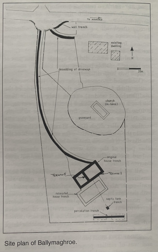
Test-trenching was undertaken at a house site as part of the requirements of Wicklow County Council for granting planning permission for construction of a dwelling. The site is beside an ecclesiastical enclosure that contains the ruins of a church and 18th-century graveyard at Ballymaghroe, Ashford, Co. Wicklow.
The ground slopes gradually down to the southern end of the site, where the proposed house is to be built. A tracking machine with a 2m-wide flat bucket was used to strip the soil to a depth of 0.2m for half the width and for the full length of the driveway, west of the graveyard. A new entrance driveway to an existing house north of the graveyard was similarly de-sodded, and a wall trench was dug to accommodate a wider entrance.
Test-trenching was carried out around the original location of the proposed house, in the percolation area and on the site of the septic tank. Trenches were dug to the depth of the undistributed subsoil where the outside-wall trenches were to be dug. The south-east trench (1) revealed a 4m-long, 0.2m-deep layer of charcoal-rich soil below the topsoil, which contained evidence of ironworking. The feature extended northward (Trench 5) to cover an area of at least 4m diameter. A second, similar feature was exposed to the north of this area.
It was agreed with the owner that a parallel set of house trenches be tested 15m south of the original position in order to avoid the necessity to excavate the feature.
No other archaeological features were recorded.

