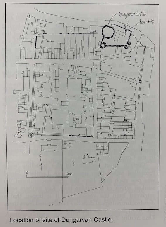
1999:847 - DUNGARVAN CASTLE, Dungarvan, Waterford
County: Waterford
Site name: DUNGARVAN CASTLE, Dungarvan
Sites and Monuments Record No.: N/A
Licence number: 95E0080
Author: Dave Pollock, ArchaeoGrafix
Author/Organisation Address: Church Lane, Stradbally, Co. Waterford
Site type: Castle - Anglo-Norman masonry castle
Period/Dating: Multi-period
ITM: E 626298m, N 593076m
Latitude, Longitude (decimal degrees): 52.088981, -7.616245
Consolidation work at Dungarvan Castle in 2000 will include the restoration of the mid-18th-century (and c. 1700) barracks and the replacement of the concrete yard surface. From late October to late December 1999 test-pits were cut through the concrete surface of the yard and through the floors of the upstanding barracks at Dungarvan Castle. The outside elevations of the barracks were drawn (the render was recently stripped), and the foot of the walls was inspected.
Little of the original barracks has survived. Much of the c. 1700 building was taken down below ground-floor window level during the mid-18th-century reconstruction; only two window openings remain, both on the ground floor.
Most of the interior of the building (all but one room and a stair passage) was cut down in the mid-18th century to insert wooden floors; the later archaeological levels were truncated in the footprint of the building. On the south and west sides of the barracks a mid-18th-century brick culvert destroyed the construction level of the original building.
This culvert, and a contemporary second culvert running from an underground water cistern, cut into a poorly mortared wall attached to the shell keep beside the drawbridge position. The wall was probably part of a later medieval fixed bridge or barbican.
Medieval surfaces of beach material (sand and gravel) were found below the south end of the barracks and below the middle of the yard, Elsewhere, to the north, the medieval ground level may have been cut away to extract clay subsoil for late defences overlooking the harbour.
The original road surface did not survive in the gateway; instead the lofty passage between the D-towers had been lowered in the late medieval period and resurfaced with beach gravel. A later fire in the passage is associated with considerable destruction (pre-dating the slighting at the end of the 17th century), recorded in the D-tower excavated in 1995 (Excavations 1995, 84–5).

