1999:745 - CLONMACNOISE, Offaly
County: Offaly
Site name: CLONMACNOISE
Sites and Monuments Record No.: SMR 5:4, 5:58 and beside 5:56 (hoard site)
Licence number: 99E0715
Author: Donald Murphy, Archaeological Consultancy Services Ltd.
Author/Organisation Address: 15 Trinity Street, Drogheda, Co. Louth
Site type: Ecclesiastical enclosure
Period/Dating: Multi-period
ITM: E 600913m, N 730669m
Latitude, Longitude (decimal degrees): 53.326277, -7.986294
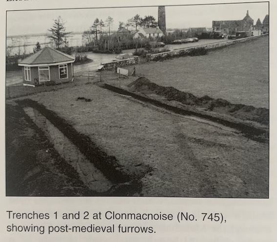
The site is within the ecclesiastical site of St Ciarán, close to the castle of Clonmacnoise and a recently discovered bridge. Midlands East Regional Tourist Authority Ltd proposes to develop a new tourist office on the site. A hoard of Hiberno-Norse coins (SMR 5:27 (1)) was found in 1979 less than 25m from the proposed development. An assessment entailing the digging of two trenches was carried out on 16 and 17 December 1999. Both trenches were excavated north-south along either side of the proposed building.
Trench 1 was excavated to the west of the site and measured 18m by 2m. A brown topsoil and sod overlay the natural, grey sand of the esker to a depth of 0.4–0.6m. Four furrows were exposed running south-west/north-east through the trench. The furrows in the centre of the trench were cut through redeposited sand and bone, which may represent the backfill of a ditch. At the south end of the trench a deposit of brown clay containing iron slag was exposed below the sod and topsoil. Animal bone was recovered from this trench.
Trench 2 was excavated along the east side of the proposed building and measured 22m by 2m. The sod and topsoil were removed by machine. Sieving of this material yielded animal bone, two pieces of cut antler, some iron slag and an iron nail. The natural, grey sand of the esker was exposed at a depth of 0.4–0.6m. Six furrows were visible cut into the sand and ran south-west/north-east, as in Trench 1. A small pit was exposed to the north of the trench, which was filled with a brown loam containing charcoal. Ash and charcoal deposits were found at the south end of the pit. To the south of the trench a band of brown clay containing stone, bone and charcoal traversed the trench from east to west and may represent a backfilled ditch along the same line as that in Trench 1. A single sherd of medieval pottery was recovered from the top of the fill of one of the furrows.
It is clear that extensive tillage took place in this area at one time. The only dating evidence was a single sherd of late medieval pottery, but this cannot be seen as conclusive. Judging from the excavated trenches, it is likely that the proposed development area contains archaeological deposits cut into or resting directly on the natural sand of the esker. A full excavation is planned for early 2000.