1999:327 - CAPPANACUSH EAST, Kerry
County: Kerry
Site name: CAPPANACUSH EAST
Sites and Monuments Record No.: N/A
Licence number: —
Author: Isabel Bennett
Author/Organisation Address: Glen Fahan, Ventry, Tralee, Co. Kerry
Site type: Standing stone
Period/Dating: Undetermined
ITM: E 482921m, N 570748m
Latitude, Longitude (decimal degrees): 51.876617, -9.700444
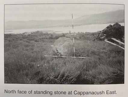
Monitoring of ground disturbance work for three house sites, a few miles west of Kenmare, was a condition of planning. Work took place between July and September. The site is on the southern slopes of Knockanaskill, between 100m and 150m OD, looking over the estuary of the Kenmare River and across to the Beara Peninsula. It was wet, boggy ground.
Although nothing of archaeological significance was noted in any of the areas monitored (and one site had been cleared without an archaeological presence because of a misunderstanding), a previously unmarked possible standing stone, 0.92m high by 0.6m wide, was noted just 8m to the east of one of the house plots. It was recorded, and the importance of its presence was stressed to the developer.