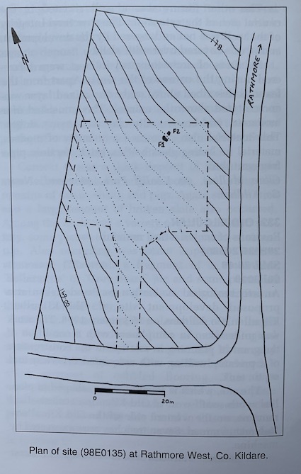
County: Kildare Site name: RATHMORE WEST
Sites and Monuments Record No.: SMR 20:9 Licence number: 98E0135
Author: Clare Mullins
Site type: Pit-burial
Period/Dating: Iron Age (800 BC-AD 339)
ITM: E 695731m, N 719337m
Latitude, Longitude (decimal degrees): 53.215820, -6.566640
Monitoring of groundworks associated with the construction of a private house in Rathmore West, Naas, Co. Kildare, was carried out in March 1998, in compliance with a condition of planning. The development site lies c. 200m south of a motte.
The site lies on sloping ground, and this necessitated the reduction of levels into the subsoil over a considerable part of the development area before foundation trenches could be excavated. During the reduction of levels towards the rear of the proposed house two areas that showed a high concentration of charcoal were identified. Further groundworks in this immediate area were halted pending investigation of these features.
Feature 1 proved to be a bowl-shaped pit that had been cut into the subsoil and filled to about half level with a series of layers of charcoal, red oxidised earth and ash. The pit had an original depth of c. 0.6m, but the upper half of the pit was filled with redeposited natural, a fact that may have hindered identification of the feature had development plans not required reduction of levels well into the natural in this area. A considerable quantity of burnt bone was found throughout the various fills of the pit.
Feature 2 consisted also of a bowl-shaped pit and was c. 0.5m deep. The fill was less spectacular than that of Feature 1 and consisted mainly of redeposited natural with a terminal deposit of charcoal and ash in the centre of the pit. It produced only a small number of tiny fragments of bone and a few larger pieces, while small flecks of charcoal occurred as occasional inclusions within the fill of redeposited natural.
The occurrence of these features, considered in conjunction with the discovery, at the end of the last century, of some inhumation burials beneath the motte, may indicate that the general area held some ritualistic importance in the late prehistoric period.
Subsequent monitoring of level reduction near these features did not reveal any further evidence of archaeological material.
Charcoal samples from Feature 1 returned a radiocarbon date range of AD 230–420 (95.4% confidence level).

39 Kerdiff Park, Monread, Naas, Co. Kildare