1996:398 - MULLINGAR: 25 Pearse Street, Westmeath
County: Westmeath
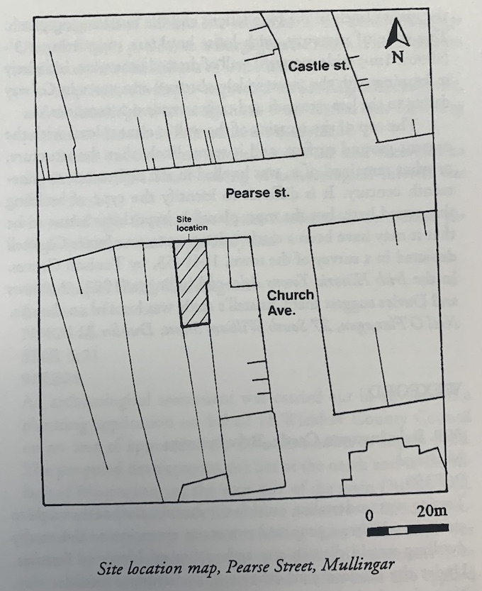
Site name: MULLINGAR: 25 Pearse Street
Sites and Monuments Record No.: N/A
Licence number: 96E0126
Author: Neil O'Flanagan
Author/Organisation Address: 27 South William Street, Dublin 2
Site type: Historic town
Period/Dating: Late Medieval (AD 1100-AD 1599)
ITM: E 644041m, N 753022m
Latitude, Longitude (decimal degrees): 53.525319, -7.335795
The development was monitored in May–June 1996. The existing house facing Pearse Street, on the main thoroughfare of the town, was to be refurbished, and a single-storey extension constructed in the backyard. The foundations in both cases comprised steel beams and columns set in concrete pads.
The excavation of the pads in the interior of the house was monitored initially by Rosanne Meenan (see Excavations 1996, No. 397). Apart from exposing the foundations of the side walls, there was no other evidence for archaeological features in the trenches.
When the excavations of the backyard were carried out, however, the overburden gave way to extant archaeological deposits up to 2m in depth. Furthermore, the remains of a mortared limestone wall with plinth ran across the yard, parallel to the back wall of the house. It was agreed, therefore, to dig the remainder of the trenches by hand and to allow the deposits to be fully recorded.
The mortared wall proved crucial to the nature of the deposits as it retained primarily loose limestone rubble. Only at the lower levels were there any extant medieval remains, including two courses of a mortared limestone wall sitting on boulder clay. On the exterior of the large mortared wall, several clays of probable medieval date were overlain by extensive humic soils of the post-medieval period. The medieval clays yielded a bone dice and a Class 8 stud-headed stick-pin in addition to most of the medieval pottery, all of which was locally manufactured. The clays abutted the foundations of the large wall only, and did not rise to its mortared face. Instead, a looser, more voluminous humic material abutted the higher levels of the foundations and the overhanging plinth. The style of masonry, with loose boulders supporting a 3′-(almost 1m-) wide mortared wall of dressed limestone, is entirely in keeping with the more widely observed structures in Galway dating to the late sixteenth and early seventeenth centuries.
The top of the remains of the wall is almost level with the present ground surface, and it seems likely that the structure, or what remained of it, was levelled in the eighteenth or nineteenth century. It is difficult to identify the type of building that stood here, but the most plausible hypothesis seems to be that it may have been a castle belonging to one James Christell depicted in a survey of the town, 1641–53, by Tenison Groves. In the Irish Historic Towns Atlas of Mullingar (1992), Andrews and Davies suggest that Christell’s castle was located on the site.