1996:161 - MAINISTIR CHIARÁIN, Oghill, Inis Mór, Galway
County: Galway
Site name: MAINISTIR CHIARÁIN, Oghill, Inis Mór
Sites and Monuments Record No.: N/A
Licence number: 96E0081
Author: Sinéad Ni Ghabhláin and Jo Moran
Author/Organisation Address: c/o 3262 San Helena Drive, Oceanside, California 92056J USA
Site type: Ecclesiastical enclosure
Period/Dating: Medieval (AD 400-AD 1600)
ITM: E 480976m, N 712032m
Latitude, Longitude (decimal degrees): 53.145495, -9.779226
A seven-week excavation was carried out at Mainistir Chiaráin between June and August 1996. The principal objective of this research project is to investigate the layout and organisation of a non-reformed monastery in the medieval period.
A cutting was opened to investigate a rectangular structure on the south side of the church. The area inside the building and a strip 1m wide outside the east and west walls were excavated. Part of the area between the north wall of the building and the church was also investigated.
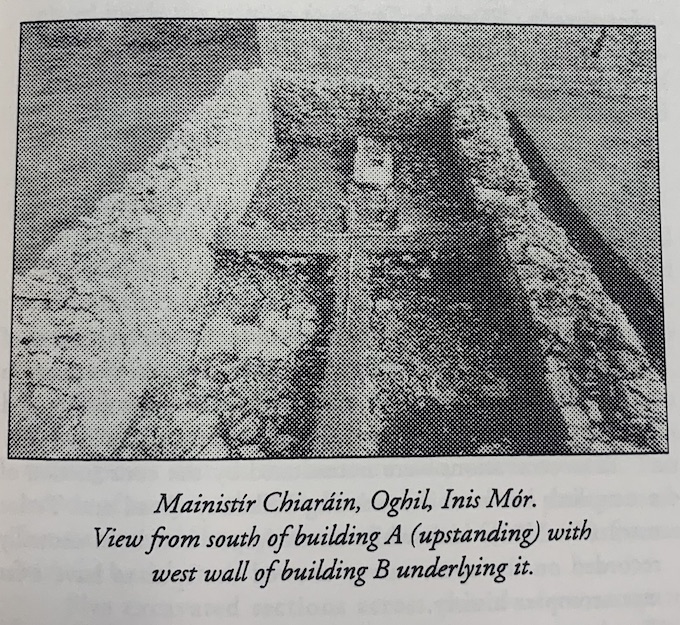
The upstanding building (A) was domestic and dated from the sixteenth/seventeenth century. It measures 8.6m by 4.4m internally and has two opposing doorways and a central hearth. Its walls are roughly constructed, with a facing of limestone blocks and an inner core of stones and yellow clay.
Artefacts associated with the occupation of Building A included a small quantity of pottery sherds, quernstones, hone stones, large bone points, nails and clay pipe fragments.
Datable artefacts, including sherds of Cologne ware, Frecken ware, clay pipes and a knife with bone handle, suggest a late sixteenth- to seventeenth-century date for the occupation of this structure.
Building A was built on the site of an earlier rectangular building (B) which abutted the south wall of the church. A central hearth, occupation level and clay floor were identified within this structure. A wall to the west of Building B enclosed the monastery to the south side of the church, and a gate between the wall and the south-west corner of the church would have controlled access to the area. The lower courses of this enclosing wall were later reused in the construction of the west wall of Building A. There were few finds associated with the use of Building B, but a number of sherds of Merida ware, recovered from a pit dug into the foundation trench of its south wall, suggest that it was in ruins by the sixteenth century. The position of Building B, abutting the south wall of the church and at right angles to it, in addition to the position of the enclosing wall, suggests a regular layout of buildings south of the church in the later medieval period.
The excavation was not completed. The surfaces on the south side of Building B were reused surfaces associated with an earlier phase of activity on the site and have not yet been examined. Excavation will continue in 1997, and a geophysical survey of the site is planned to identify other buried structures in the vicinity of the church.
This excavation was funded by the Royal Irish Academy and by the University Research Expeditions Program, Berkeley.