1996:018 - CARLOW CASTLE, Carlow, Carlow
County: Carlow
Site name: CARLOW CASTLE, Carlow
Sites and Monuments Record No.: SMR 7:01802`E105
Licence number: —
Author: Kieran O'Conor
Author/Organisation Address: Annagh, Ballyfarnon, Boyle, Co. Roscommon
Site type: Castle - Anglo-Norman masonry castle
Period/Dating: Late Medieval (AD 1100-AD 1599)
ITM: E 671435m, N 677138m
Latitude, Longitude (decimal degrees): 52.840448, -6.939679
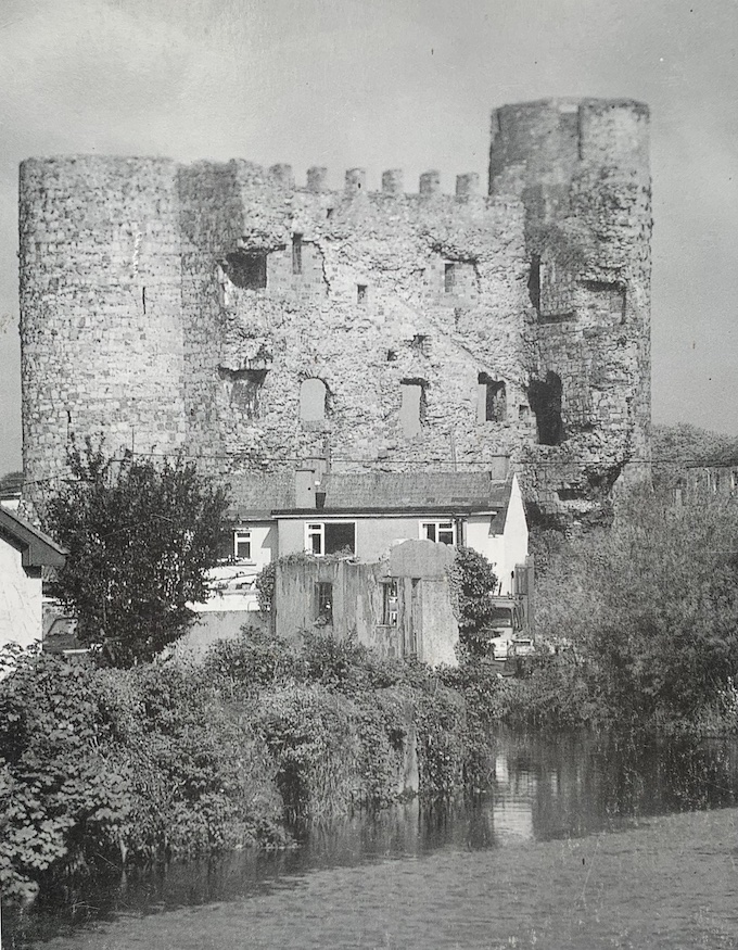
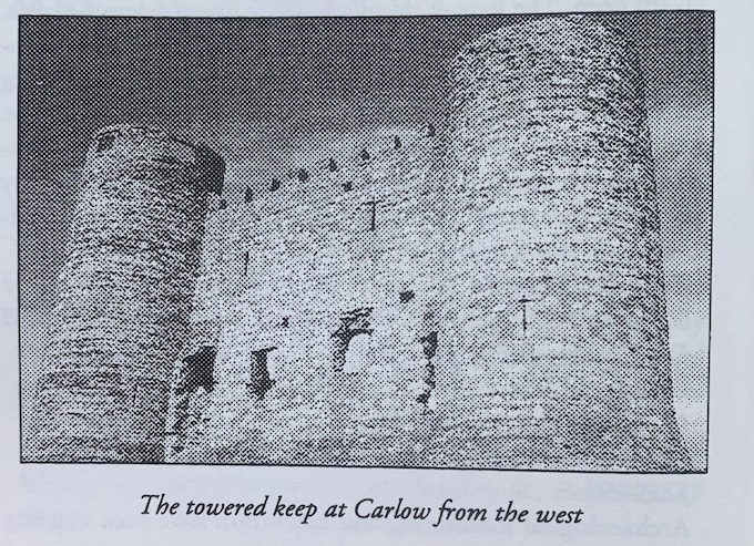
An eight-week excavation uncovering an area of 246m2 was carried out at Carlow Castle between May and July 1996. The excavation was funded by the OPW in advance of conservation. The standing remains at the castle consist solely of the western half of a towered keep. The eastern half of this building collapsed in 1814 and its stonework was subsequently broken up and carted away from the site.
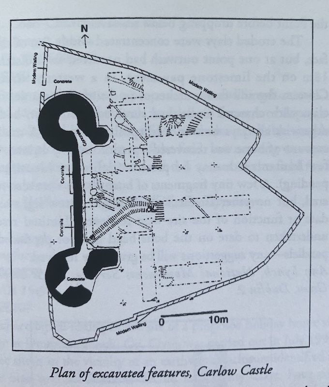
Carlow Castle is sited upon a slight rise located at the confluence of the Barrow with the Burren, which lie to the west and south of the site respectively. It would appear that this low knoll was originally bounded by wet marshy ground on its northern and eastern sides. It became clear in the first weeks of the excavation that much of this low rise had been quarried away during the eighteenth and nineteenth centuries. Therefore work concentrated on what had been the interior of the towered keep.
A major result was finding the remains of a series of post-holes inside a curving ditch, all of which have been truncated, running under the walls of the towered keep and therefore pre-dating it. The remains of a corn-drying kiln were also found to the north of this ditch and palisade. This feature also occurs under what was the original line of the western wall of the keep and appears to be contemporary with the post-holes and fosse. All these pre-towered-keep features were interpreted as representing the remains of the first castle here, whose defences and buildings seem to have been constructed of earth and timber. Furthermore, a reinterpretation of the historical sources suggests that this primary timber castle was built in the early 1180s by Hugh de Lacy for John de Clahull.
The next phase of activity at the site saw the erection of the towered keep itself. The architecture of this building and an analysis of the available historical sources indicate that it was begun about 1210 at the behest of William Marshal the Elder, although it may have taken a number of years to complete fully. The erection of a stone castle at Carlow was linked to Marshal’s plan to create a strong market town here on the banks of the navigable Barrow that would trade downriver with New Ross.
The first act in the building of the keep was to completely flatten the top of the rise down to subsoil. This levelling of the summit of the knoll cleared away most of the defences and buildings belonging to the primary timber castle. However, the bases of this first castle’s fosse and corn-drying kiln (see above) were still visible even after this flattening because they had been cut quite deeply into the subsoil of the rise. They had to be deliberately filled in to the level of the flattened knoll. Most of this fill in both the kiln and ditch seems to have come from the occupation of the just-levelled timber castle.
Animal bone, iron slag, two sherds of Leinster ware and one sherd of glazed pottery, apparently locally made, occurred within this matrix. However, two dumps of stone were also placed in the ditch at the points in it that were to be crossed by the walls of the proposed keep. Ordinary soil, even if quite compacted, was not considered solid enough support for them.
The next stage saw the construction of the towered keep on this level area. The keep had no foundations, being erected on an artificially created, flattened ground surface. The builders seem to have realised that this flattened area was perfectly capable of taking the downward thrust of the walls. Furthermore, the two dumps of stone placed in the truncated ditch of the primary castle to take the walls of the keep give an indication of the original internal dimensions of the latter building. The keep appears to have had internal measurements of 15.8m north-south and c. 8.85m east-west.
Very little occupation evidence was uncovered. The disturbance caused by the collapse of half of the keep in the early nineteenth century, the subsequent robbing out of much of the stonework and the fact that the whole site was turned into a vegetable garden after c. 1850 seem to have destroyed any occupation layers. The excavation did produce evidence for modern cultivation furrows cut into the subsoil of the rise within the interior of the keep. However, it must also be remembered that actual habitation in a medieval keep or tower house took place in its upper floors. The ground floor was invariably used for storage. This must have meant that there was never a great build-up of occupation debris in the basements of keeps, hall-houses and tower houses. The fact that there were probably never substantial habitation layers within the interior of the keep here might explain why so few finds of medieval date were found throughout the site, even in disturbed contexts.
However, the excavation did locate the castle’s well. This was sited in the north-eastern corner of what would have been the towered keep’s basement. All of the well’s upper stonework was robbed out at some stage, probably in the nineteenth century.
An image of Carlow Castle was included on the cover of the Excavations 1996 bulletin, photo courtesy of Chris Corlett.