1975:045 - DUNGIVEN, Derry
County: Derry
Site name: DUNGIVEN
Sites and Monuments Record No.: N/A
Licence number: —
Author: A. D. Bratt, Historic Monuments & Buildings Branch, Department of Environment (NI)
Author/Organisation Address: —
Site type: Standing Stone
Period/Dating: Undetermined
ITM: E 669337m, N 908489m
Latitude, Longitude (decimal degrees): 54.919311, -6.918462
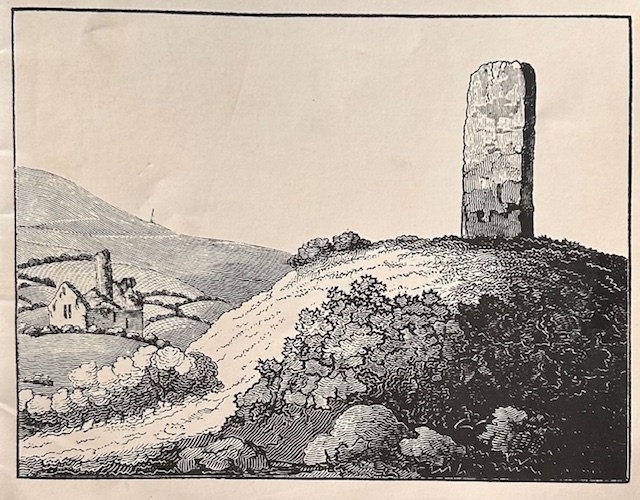
The stone stands on a low mound, 15m in diameter, the W side of which was threatened by the A.6/Dungiven by-pass scheme. A trench dug radially on the NW revealed severe disturbances. This had been caused partly by burrowing animals, partly by Sampson’s excavations in the early 19th century.
The stone had been erected on the summit of a natural hummock. It seems to have been enclosed by a circular palisade or fence. Subsequently, the hummock was built up with soil and turf to form a platform, 6.8m in diameter, around the stone. The extensive disturbance found, together with the limited area opened, made a more coherent interpretation impossible. All the small finds recovered came from the disturbed layers.
The cover of Excavations 1975-6 featured the below image, designed by A. H. Everleigh, based on a view of Dungiven (Sites 11–12, 1975) taken from Simpson’s 1814 Survey of Londonderry.