1954:016 - EDMONDSTOWN (PAR. RATHCONNELL), CO. WESTMEATH, Westmeath
County: Westmeath
Site name: EDMONDSTOWN (PAR. RATHCONNELL), CO. WESTMEATH
Sites and Monuments Record No.: SMR WM013-048SMR WM020-042
Licence number: E1168
Author: ELLEN PRENDERGAST
Author/Organisation Address: —
Site type: Graves of indeterminate date
Period/Dating: —
ITM: E 652435m, N 759488m
Latitude, Longitude (decimal degrees): 53.582646, -7.208132
Introduction
In March 1954 human remains were discovered during the levelling of a low mound near Killucan, Co. Westmeath. The work was being carried out with a pick and shovel in preparation for ploughing. Fragmentary unburnt bones were found in the mound, which was located in the centre of a large field east of a large farmyard. The bones were put aside and kept by the workers at the site. The discovery was reported to the Gardaí at Delvin, who reported the find to the NMI. The site was visited by Ellen Prendergast. This report is based on Prendergast’s account of the site.
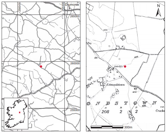
Location (Fig. 6.52)
The site was in the townland of Edmondstown, approximately 7km south-west of Delvin, east Co. Westmeath.86 It is marked as a ring-barrow in the SMR87 for County Westmeath. The site was at an altitude of approximately 120m above sea level in the centre of a large field approximately 150m south of the border between Edmondstown and Jeffreystown townlands. The land was on the estate of the Reynells of Killynan Pratt.
Description of site
The site is described by Prendergast as being delimited by a very low bank that had been flattened in places and was not more than 0.3m high at its maximum. The centre of the structure was somewhat sunken and this was thought by Prendergast to be due to the felling of a tree at the centre of the mound fifteen years previously. According to the workers at the site the mound had not been ploughed in the last 50 years.
When the topsod was removed it was noticed that the structure was formed of sand and gravel, in contrast to the soil in the surrounding field. There was no evidence of individual graves, and the bone was found in a disturbed condition. The workers who found the bone did not notice any stone protection around the skeletons. It was not possible to determine the alignment of the graves.
Comment
The site consisted of a scatter of unburnt human bone (P1954:1) in the bank of the mound at a depth of about 0.5m. The finders could not recall the original position of the bones, and Prendergast noted that many of the bones bore old breaks that would indicate previous disturbance, perhaps when the trees on the mound were felled. As there were no associated finds or other dating evidence this site must be recorded as undated. As the site has been identified as a ring-barrow, however, it is probable that the human remains recovered are of prehistoric date. The bones from this site have not been examined.
86. Parish of Rathconnell, barony of Moyashel and Magheradernon. SMR WM013-048——. IGR 252496 259467.
87. WM013-048——.