2026:134 - John Street, Cashel, Tipperary
County: Tipperary
Site name: John Street, Cashel
Sites and Monuments Record No.: TS061-025----
Licence number: 26E0413
Author: Michael Greiner & Seán Shanahan; Shanarc Archaeology Ltd.
Author/Organisation Address: Unit 39a, Hebron Business Park, Hebron Road, Kilkenny
Site type: Historic Town
Period/Dating: Modern (AD 1750-AD 2000)
ITM: E 607649m, N 640517m
Latitude, Longitude (decimal degrees): 52.515974, -7.887305
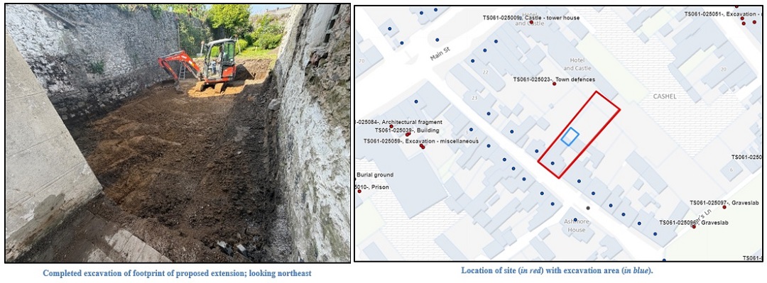
Archaeological monitoring of groundworks associated with the development of a single-storey extension to the rear of an existing dwelling house at John Street, Cashel, Co. Tipperary was carried out on 26 and 27 May 2026.
The site is located within the Zone of Notification (Zone ID: R135763) for the historic town of Cashel (TS061-025—-), and lies in close proximity to the medieval town defences (TS061-025023-) which are a national monument under the National Policy on Town Defences 2008.
The existing dwelling house within the site is a Protected Structure (RPS: 102) and is included in the National Inventory of Architectural Heritage (NIAH: 22105063).
Monitored works comprised the demolition of a stone lean-to shed to the rear of the existing house, and the bulk excavation of the floor of the demolished shed and the portion of the garden within the footprint of the proposed extension.
A concrete floor slab (0.2m deep) covered the footprint of the demolished shed. Below the concrete floor, the remains of a single partial layer of cobblestone was noted (c. 0.12m deep) resting on a bed of black silt. The remainder of the excavation area was filled with a thick deposit of dark brown garden soil. The footprint of the proposed extension was bulk excavated to formation level (1.3m deep). The subsoil material below the garden soil comprised a moderately compact orange-brown sandy silt with occasional small sub-rounded stones. The remains of a c. 4m long wall foundation associated with the late 19th- to early 20th-century outbuildings shown on the 25-inch OS map, were exposed at the east-northeast of the excavation area at a depth of 0.3m below the topsoil.
With the exception of the partial cobble remains and the small section of wall foundation, no archaeological finds, features or deposits were noted during the monitored works.