2026:334 - Market Yard, Gardens (St Mary’s Parish), Kilkenny City, Kilkenny
County: Kilkenny
Site name: Market Yard, Gardens (St Mary’s Parish), Kilkenny City
Sites and Monuments Record No.: KK019026---- (Historic Town)
Licence number: 25E0246 ext.
Author: Paul Stevens/Archaeological Management Solutions Ltd
Author/Organisation Address: 19 High Street, Kilkenny
Site type: Urban buildings
Period/Dating: Modern (AD 1750-AD 2000)
ITM: E 650541m, N 656078m
Latitude, Longitude (decimal degrees): 52.653537, -7.253023
Archaeological Management Solutions (AMS) were engaged by John Cradock Ltd. on behalf of Kilkenny County Council to carry out an archaeological excavation at the Market Yard at the proposed site of a new bandstand. The site topography is a low-lying flood plain, with former natural springs and diverted river channels draining northeast into the River Nore. This report concerns an archaeological rescue excavation as a result of discoveries made during previous archaeological monitoring for the same development; comprising two phases of site investigations, including geotechnical works carried out in 2023 (see DIER 2023:465) and utility slit trench works carried out in 2025 (see DIER 2025:742).
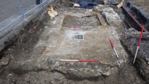
The Market Yard archaeological excavation site comprises a large open area measuring 149.69m2 and up to 2.6m in depth, that was opened by supervised mechanical excavator, down to the level of extant archaeological soils, walls, surfaces and/or structures, which were fully recorded and excavated by hand and/or supervised machine.
Five phases or levels were recorded during the excavation. The primary level (0) represented wetlands, with evidence of intermittent flooding and peat development. During this phase, the area was an uninhabited marshy wetland, with adjacent medieval settlement in evidence close by. The next level (1) represented organic and inorganic garden soils that represented a single phase of post-medieval reclamation. Level 2 represented the construction of two conjoined buildings (Building 1 and Building 2) formed by three seventeenth- or eighteenth-century walls. These walls were built on complex foundations of timber piles and/or timber rafts, supporting a stone wall-base. An upper level (3) represented early–mid nineteenth-century repair, reconstruction and truncation. Four associated structures were revealed, plus an un-associated wall and stone-lined well (preserved in-situ). This also comprised the partial demolition of the contemporary buildings and the development of the Fish Market on the site. Finally, modern overburden that sealed the site, was the result of demolition of these buildings for present carpark and associated road layout.
A modest assemblage of archaeological objects recovered include medieval and post-medieval ceramics, post-medieval glass, some nails and building materials. Over 100 worked and unworked wood samples were taken, plus a small animal bone and oyster shell assemblage.
Archaeological monitoring is ongoing for the remainder of the Saint Kieran’s Street and Market Yard Enhancement Scheme and further reports will be forthcoming.
Archaeological monitoring of construction groundworks for this scheme continues in 2026, in addition to rescue excavation, as required and subject to approval by the statutory authorities.