
2025:736 - Corratanvally, Mayo
County: Mayo
Site name: Corratanvally
Sites and Monuments Record No.: N/A
Licence number: 25E0258
Author: Richard Gillespie, Mayo County Council
Author/Organisation Address: Mayo National Roads Office, Glenpark House, The Mall, Castlebar, County Mayo
Site type: N/A
Period/Dating: N/A
ITM: E 519641m, N 788825m
Latitude, Longitude (decimal degrees): 53.842685, -9.221087
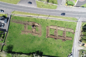
Test trenching of a proposed fill area at Corratanvally Td. was carried out as part of the proposed N60 Breaffy Active Travel and Safety Measures scheme, Co Mayo.
No archaeology was found.
This fill area covers roughly half of a fairly flat 0.4ha field, which was previously in use as improved pasture. There are two known archaeological monuments within 250m of this fill area: A mound (MA:079-040) at a distance of 187m from its Zone of Notification and a Barrow (MA:079-041) at a distance of 232m from its Zone of Notification. There is no predicted impact on these or any other known Cultural Heritage sites.
Stratigraphy: The sod and topsoil were fairly compact, mid-brown topsoil with frequent small stones. This fits within the definition of the “brown clay” soil type which is common within the area. The interface between the topsoil and subsoil included dense concentrations of smaller stones.