2025:379 - DUBLIN 1: Saint Mary's Place Flats, Dorset Street Upper, Dublin
County: Dublin
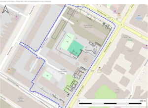
Site name: DUBLIN 1: Saint Mary's Place Flats, Dorset Street Upper
Sites and Monuments Record No.: DU018-020
Licence number: 24E0740
Author: Antoine Giacometti, Archaeology Plan
Author/Organisation Address: 129 North Strand, D03 W8C1
Site type: Town
Period/Dating: Modern (AD 1750-AD 2000)
ITM: E 715302m, N 735134m
Latitude, Longitude (decimal degrees): 53.353835, -6.268015
A programme of archaeological monitoring was carried out at St Mary’s Place, Dorset Street, Dublin 1, in advance of a Dublin City Council residential development. The site was previously occupied by 1960’s Dublin City Council flats, which have since been demolished, and occupies an urban block surrounded by Dorset Street Upper, Dominick Street Upper, Mountjoy Street and Saint Mary’s Place, and was known as Dorset Street Saint Mary’s Place Flats.
Archaeological monitoring took place from early September 2024 to March 2025. The archaeological monitoring identified the basements of sixteen former houses, and these were fully exposed and excavated, out of the thirty-two house plots in the zone of excavation. Most of the basements were previously damaged by the 1960’s Dublin City Council development or the 1901 construction of the red brick fire station.
The 1960’s redevelopment of this urban block involved the demolition of all the Georgian houses on the site, the levelling of the ground, and the digging of deep foundations for the Dorset Street – St Mary’s Place flats. Despite this, the basements of sixteen eighteenth-century houses were preserved underground, and were excavated and recorded as part of the 2024-2025 monitoring programme. The house basements and wall foundations matched their projected form based on cartographic sources, though many of the basements had been modernised with concrete walls and floors and new services, as these had been occupied right until the 1960’s redevelopment. Some of the house basements had grafitti, for example No. 140 had “Peter Gilligan… 23rd Dec 1952… Kilbeg… Kild..”
A small amount of artefacts were recovered from the demolition and back fills of the previous construction from the 1960s. These artefacts, dating from the late eighteenth and nineteenth centuries, would have formerly belonged to the households of Nos 122-146 Dorset Street Upper and Nos 1-8 Dominick Street Upper. The relative rarity of artefacts probably reflects the municipal organisation of rubbish disposal over the twentieth century (in the eighteenth-century household rubbish was often discarded in pits in the rear gardens).
As well as the foundations and basements of Georgian houses, the monitoring programme also recorded drains and walls relating to the many laneways that traversed the block and gave access to its interior. Laneways such as Long Lane, Pender’s Court, Butler’s Court, Windsor Court, King’s Lane and Walsh’s Row.
No archaeological features earlier than the eighteenth century were discovered.